it was too much to drive from Rocky Mountain National Park to to Custer State Park, so I’d booked one night at the Riverside RV park in Scottsbluff, NE. The bluffs were pretty cool (see Russ’s blog: russloomis.com), but the RV park turned out to be a good example of why I usually avoid RV parks: noisy, crowded, and over-lit at night. I have no idea how Russ managed to sleep in his tent under lights better suited to a football stadium. By the time I got up at 6 am, I wanted out of there. We left at 8 am.
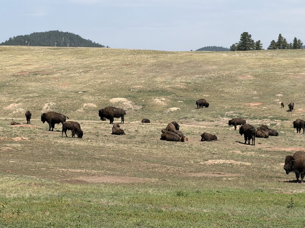
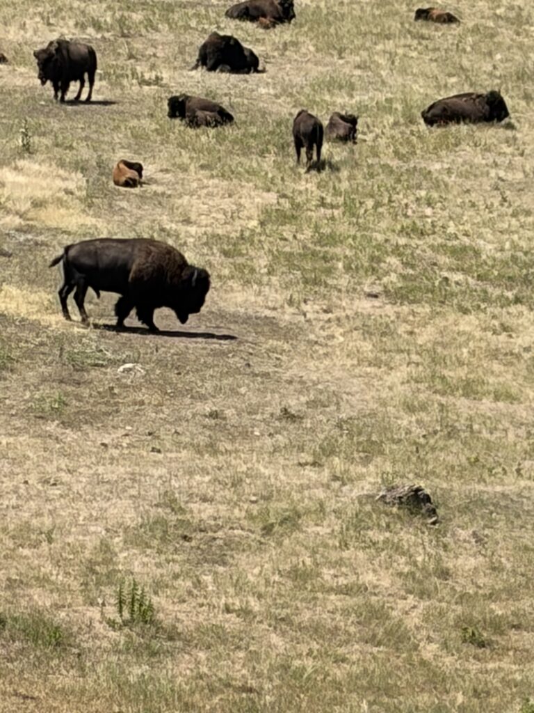
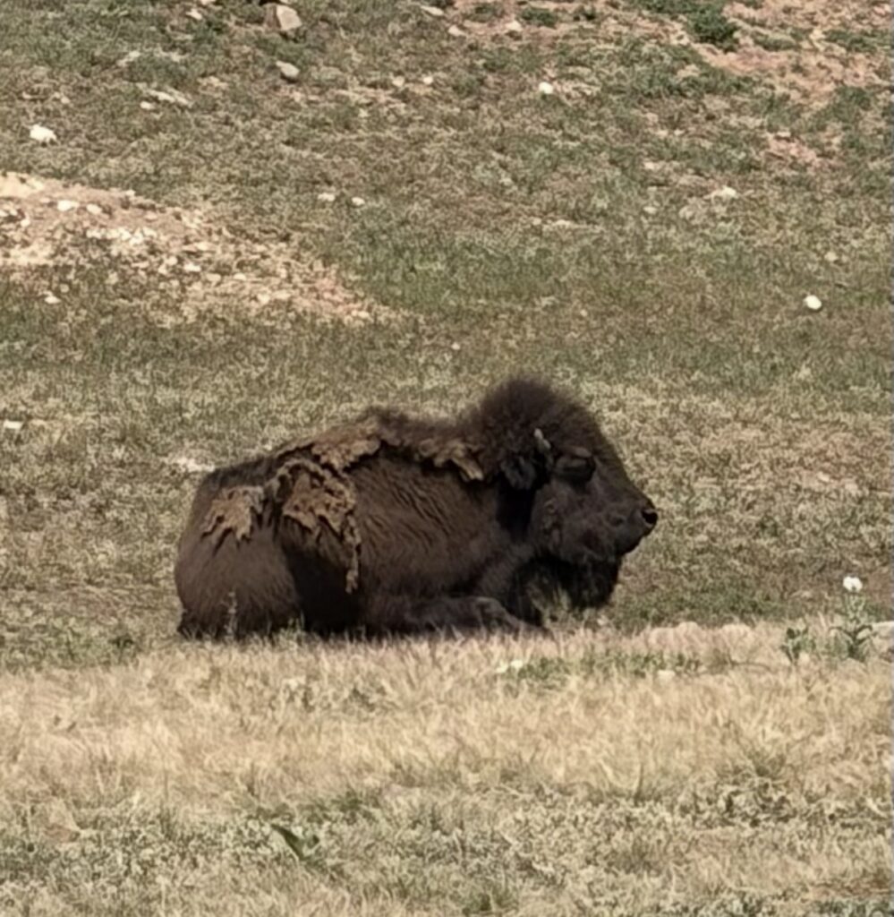
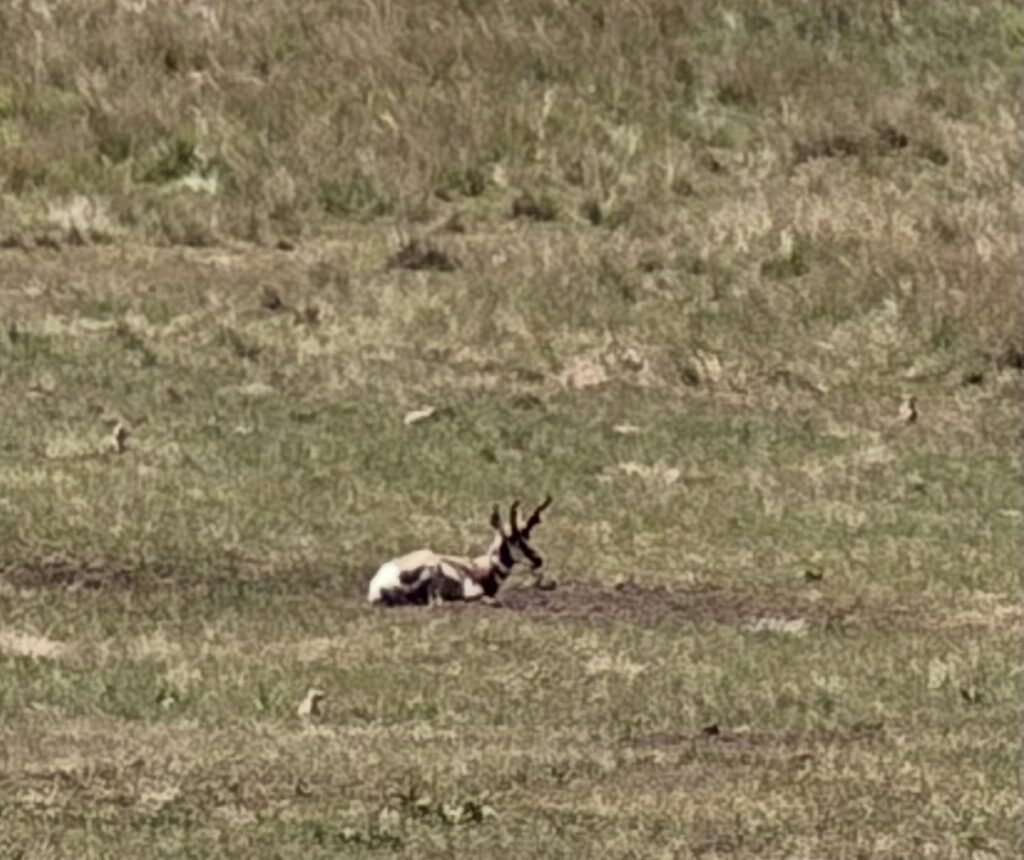
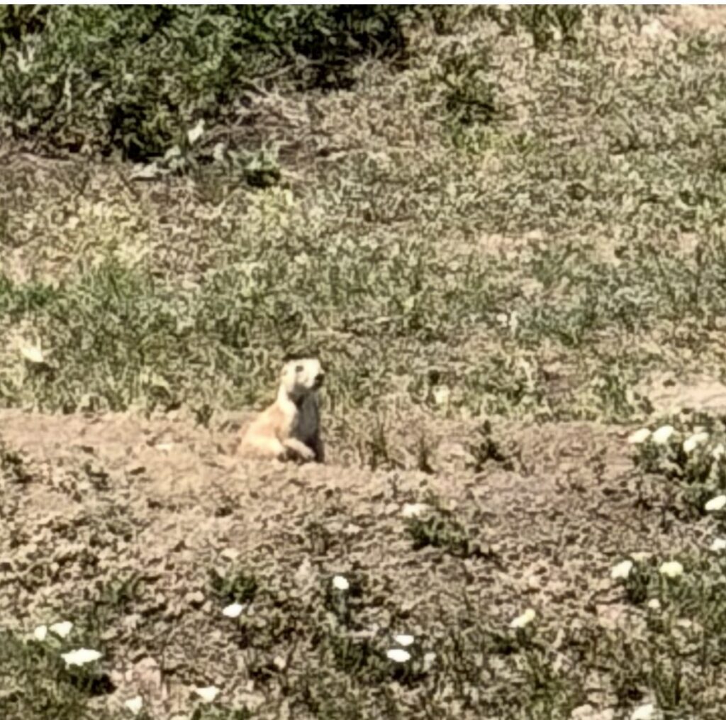
We were early, so stopped off at Wind Cave National Park, which I’d never heard of, to see if we could tour the cave. Unfortunately, the tours were booked until later in the afternoon, so we made a note to try again on another trip. Arriving early at Custer State Park worked out just fine, as we came into the park through the wildlife loop, which did not disappoint.
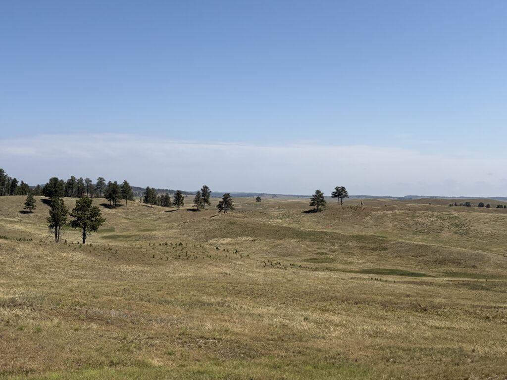
Rolling hills of South DakotaLots of bison!Big bullBigger bullPronghorns…and Prairie Dogs!
There was a bit of a problem when we arrived at our campsite: we arrived a day later than originally booked; I’d tried to notify them by calling the main booking office, but apparently the message didn’t get through. Our site had been given to someone else. After going through at least three levels of beaurocracy, we were given a backup site (no shade, but electric hookup). No big tragedy; we were only there for one night.
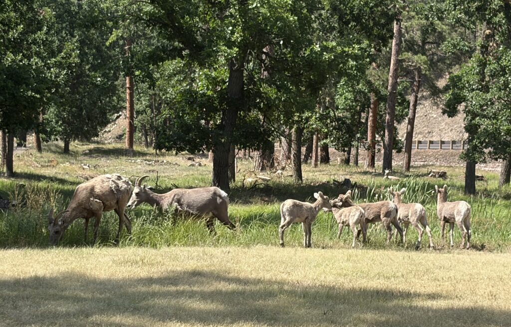
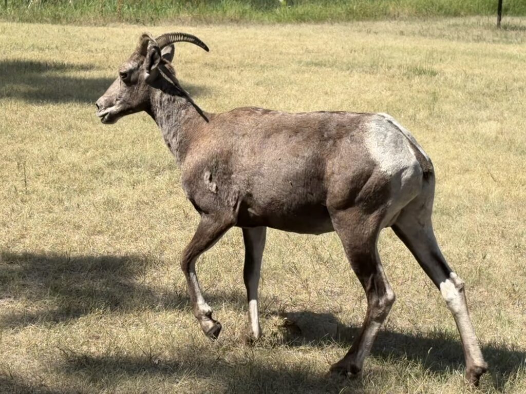
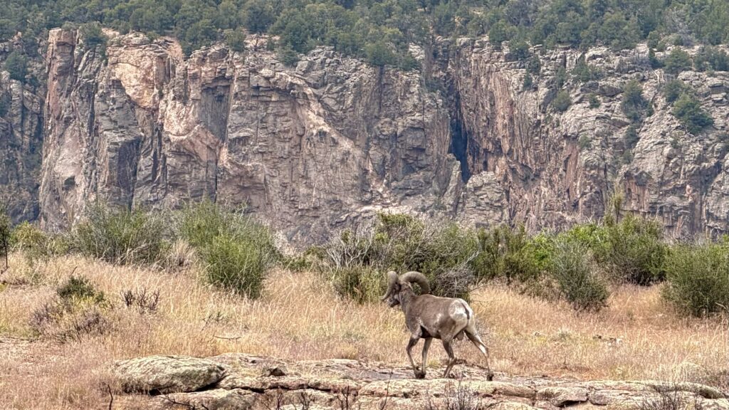
And the park continued to delight. As I drove the short distance to the camp store to pick up provisions, I encountered a herd of bighorn sheep right by the road. I pulled in, and watched the ewes and lambs graze in the small grassy area right next to the parking lot.
I learned that ewes and rams both have horns, but only the rams develop those distinctive big curled horns. The lambs, like lambs everywhere, gamboled about adorably.
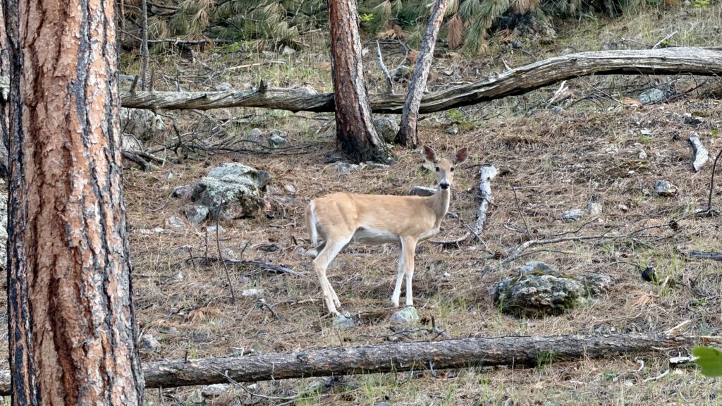
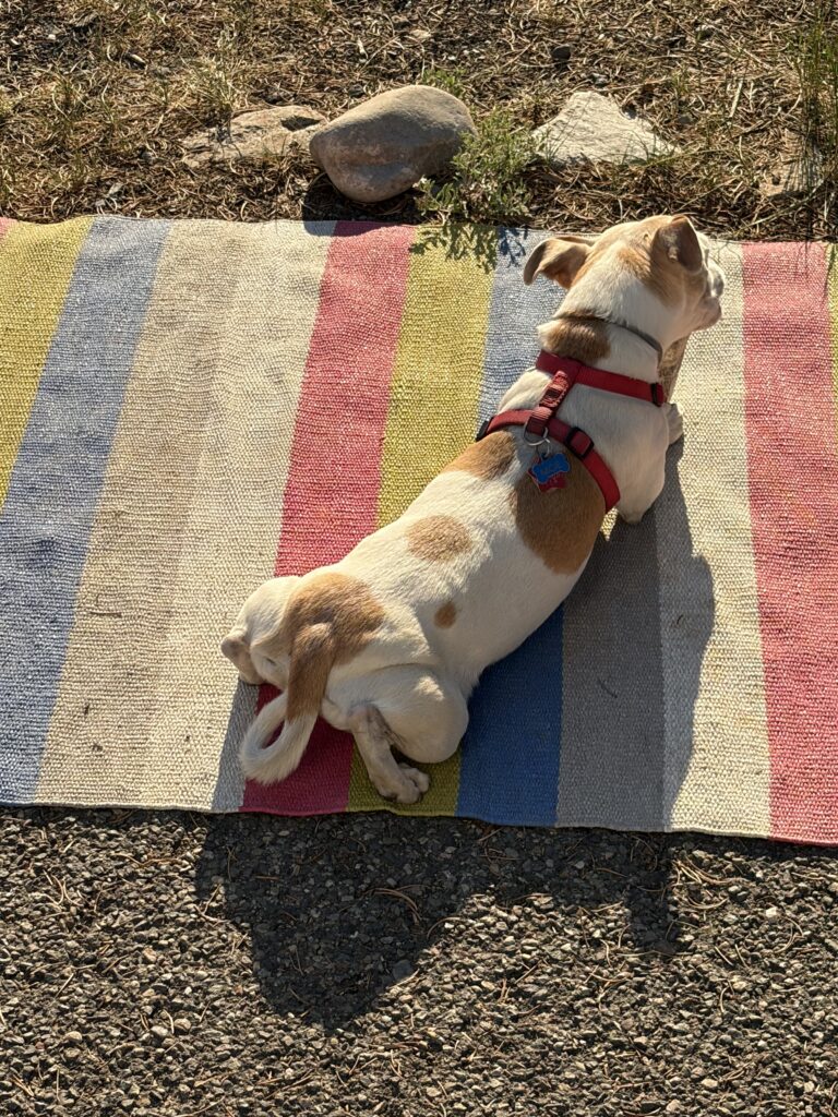
After dinner we took Moe for a walk along the paved hiking/biking path and saw even more wildlife: this time, mule deer relaxing near the path.
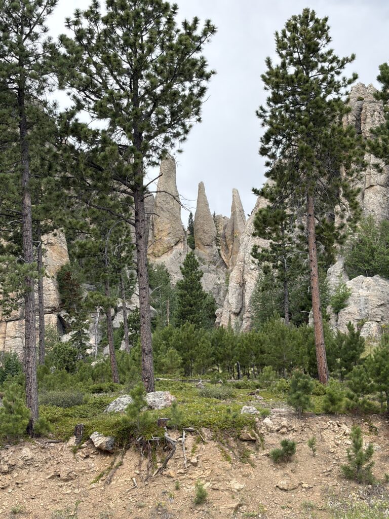
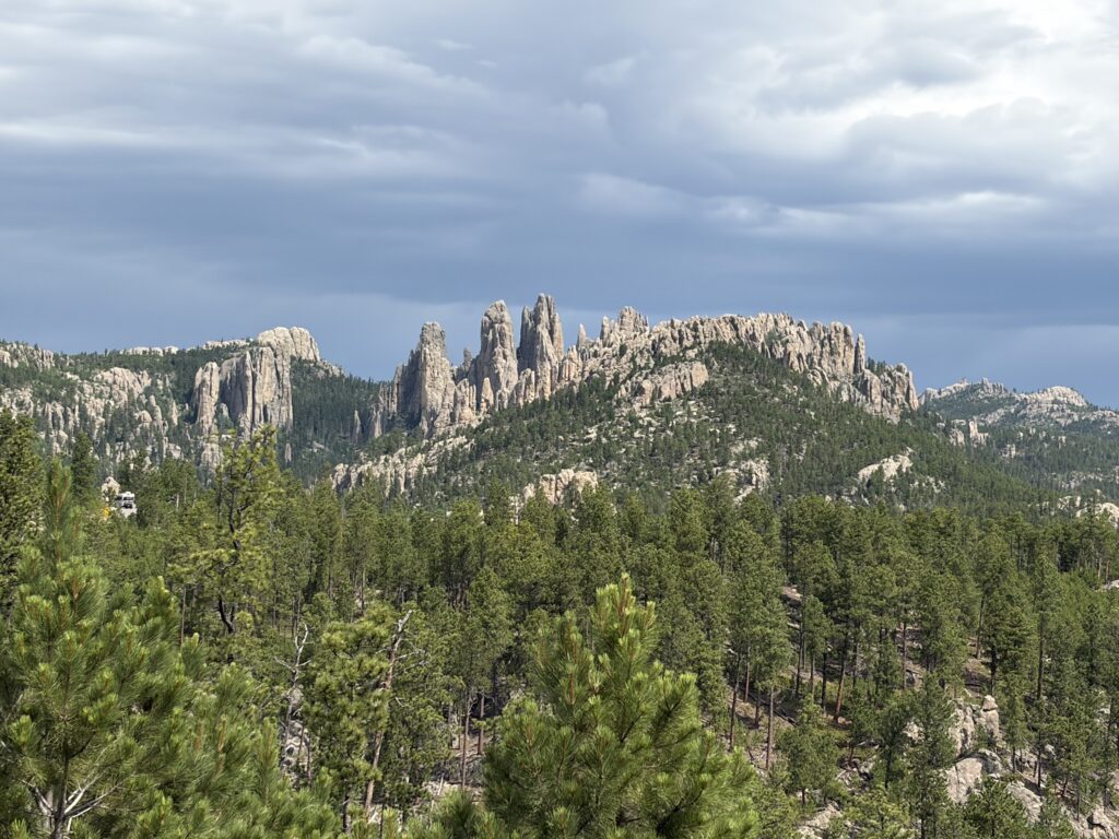
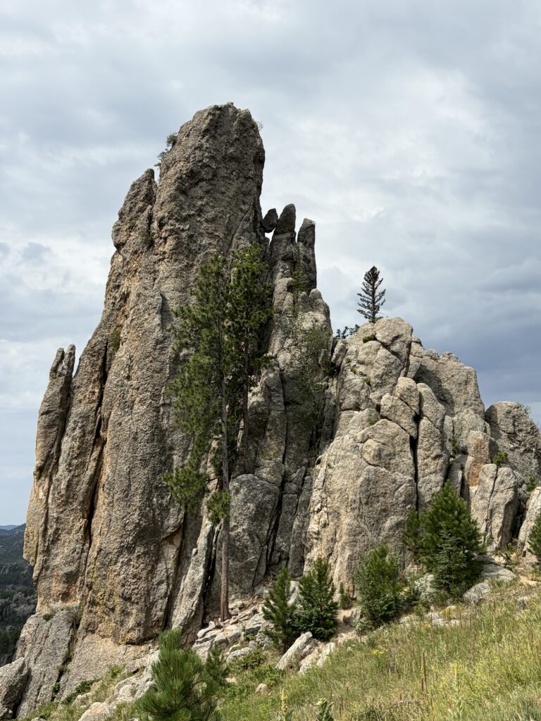
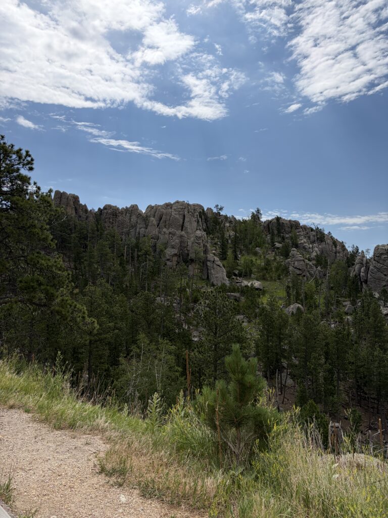
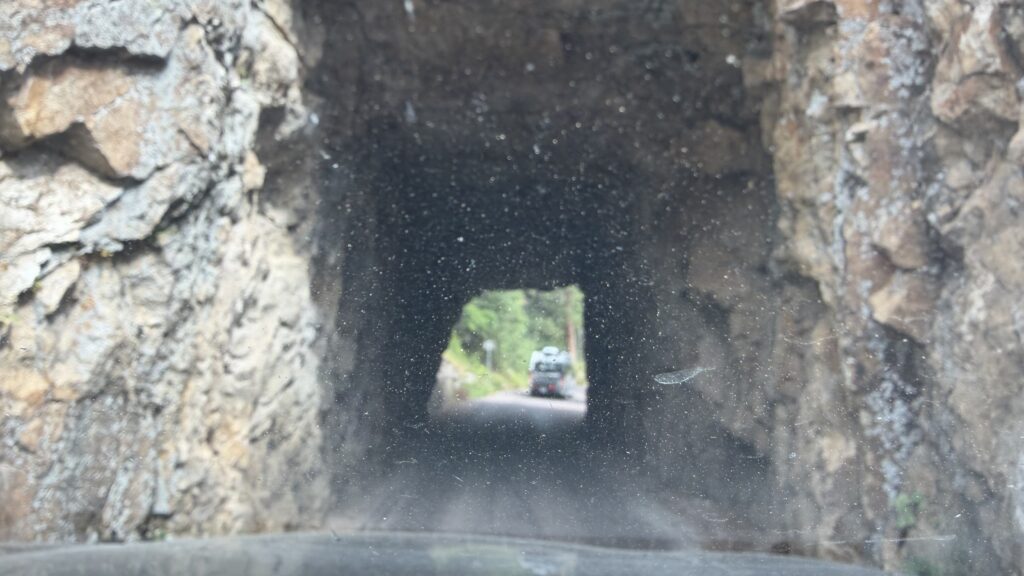
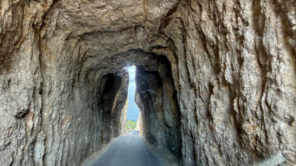
The evening was cool and lovely, and the next day had more surprises for us, as the road out of the park went through some pretty spectacular scenery, and some heart-stoppingly small tunnels.
This is why it was called Needles HighwayYes, I drove the camper through that!
There was less than a foot to spare through that last tunnel. The car and camper are still intact—phew!
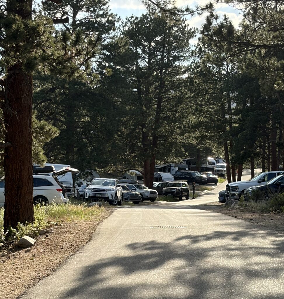
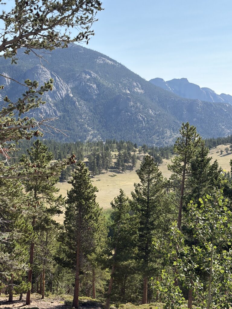
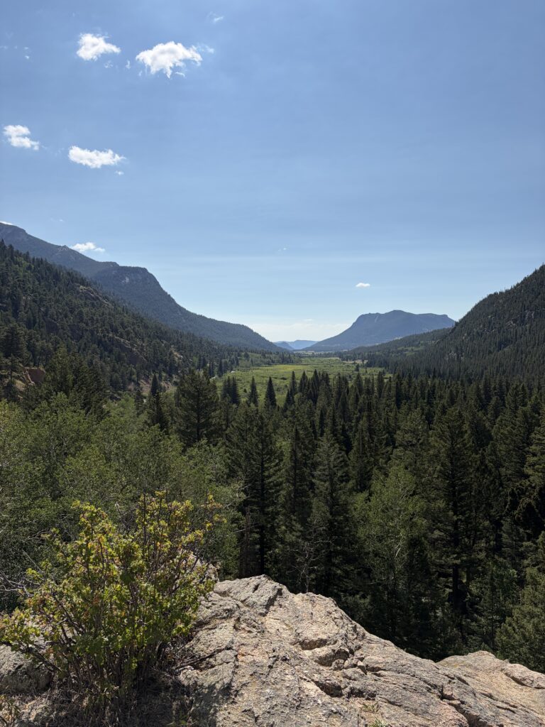
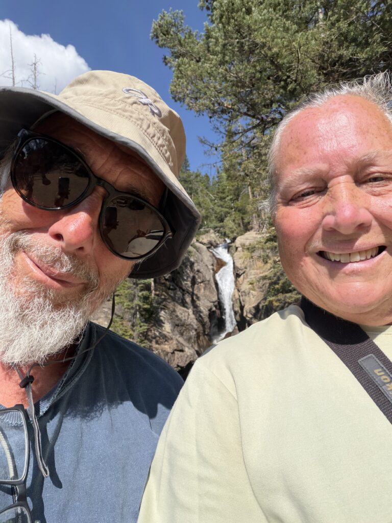
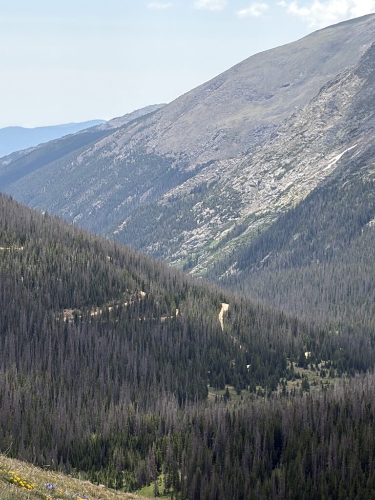
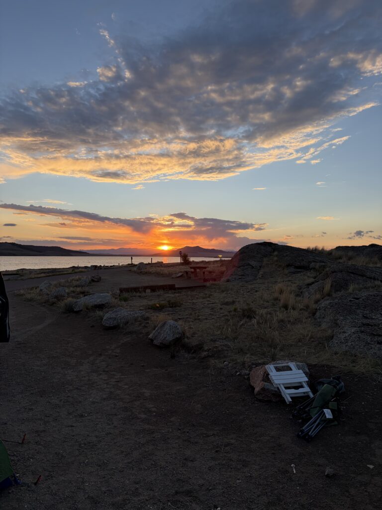
Like Glacier, Makoshika, and a few other places we’ve been, words can’t describe Rocky Mountain National Park, and even the best pictures can’t do it justice. One thing I did notice was that overcrowding has become the norm since we first went traveling in ‘22.
Our campground (on a weekday, no less)
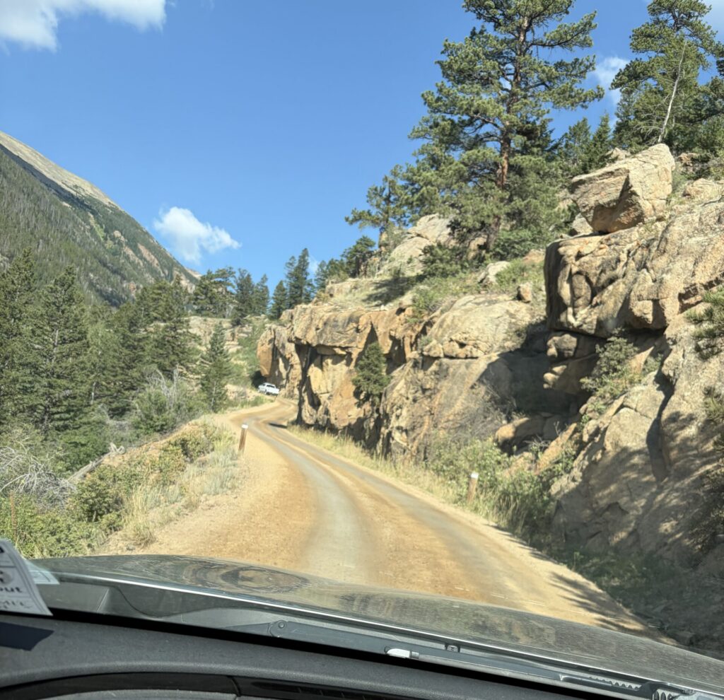
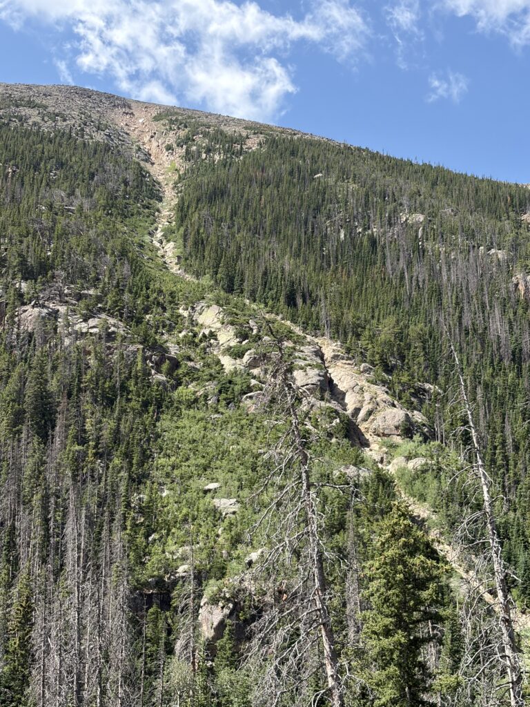
It also means that reservations are hard to come by, unless you book 6 months or a year in advance. I was only able to get two nights, which only left one full day to explore. We decided to drive up the one way, dirt, Old Fall River road to the Tundra Visitors’ Center and then down the paved Trail Ridge Road. An excellent choice, as it turned out, even if the twisty, narrow road and multiple hairpin turns had Russ in a near-constant state of panic.
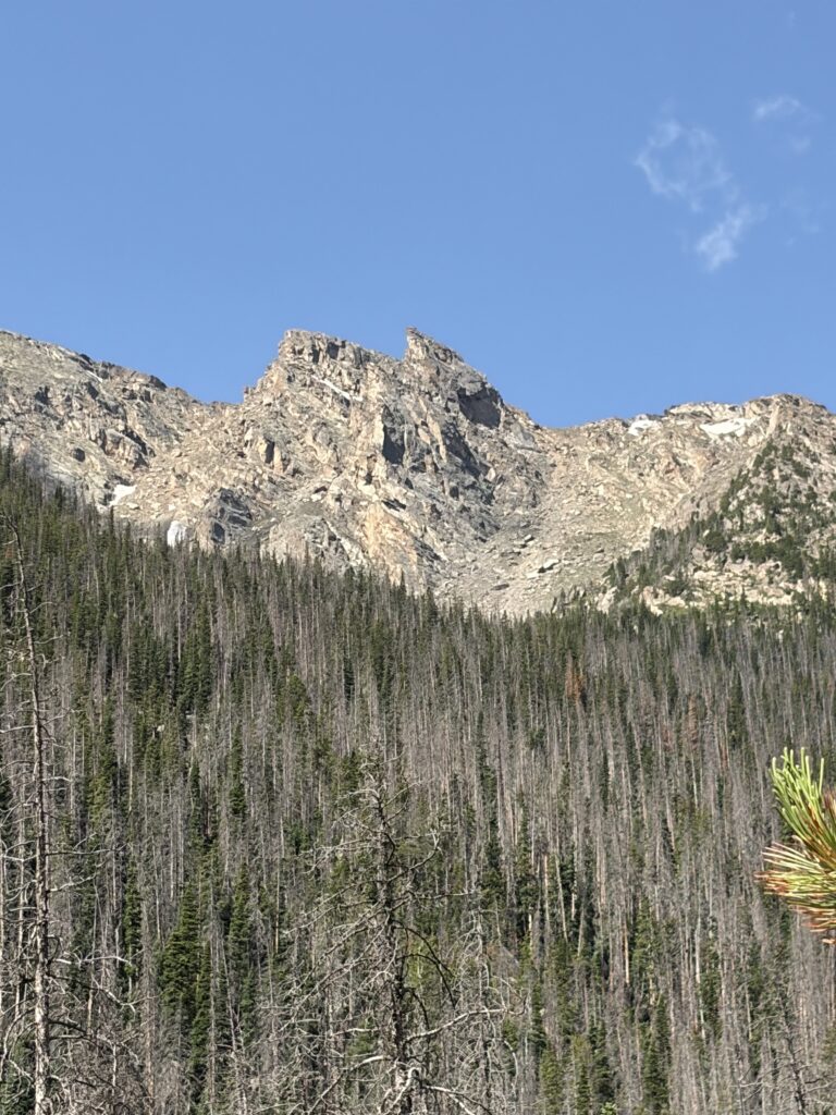
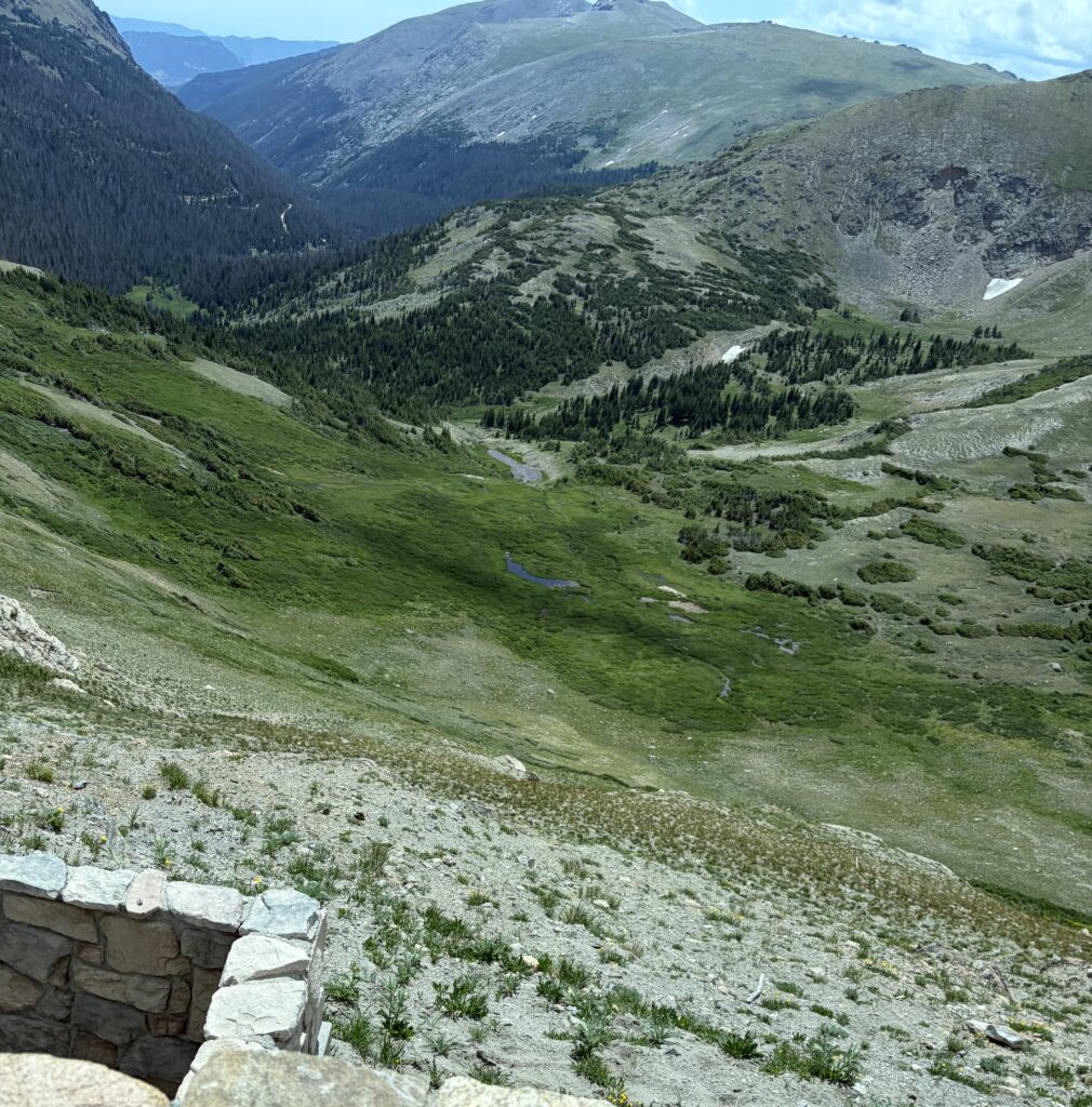
We stopped at the Tundra Visitors Center, where I learned that the volcanic caldera (I was SURE it was a caldera) was instead a glacial cirque (aka birthplace of glaciers), and that the wafer-thin wedge of snow at the top was indeed a glacier. Glacier or snowfield? One is permanent—guess which. We had a snack and some cold drinks while Moe made friends and got to sniff a real elk antler.
That’s a glacial cirque—and that sliver of snow? That’s a glacier.
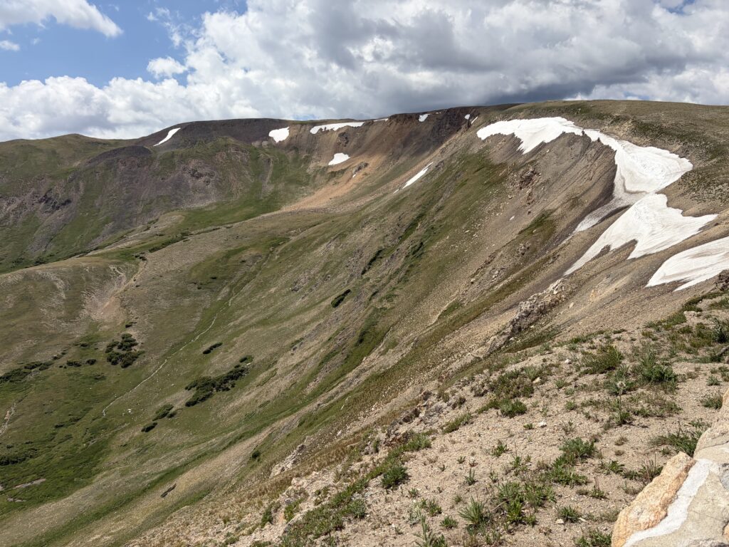
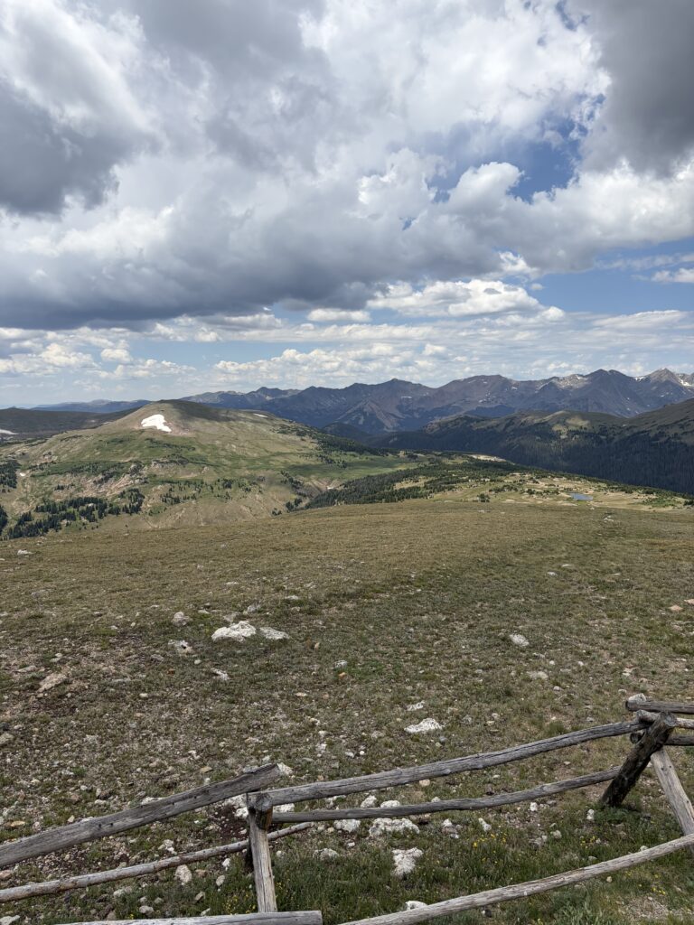
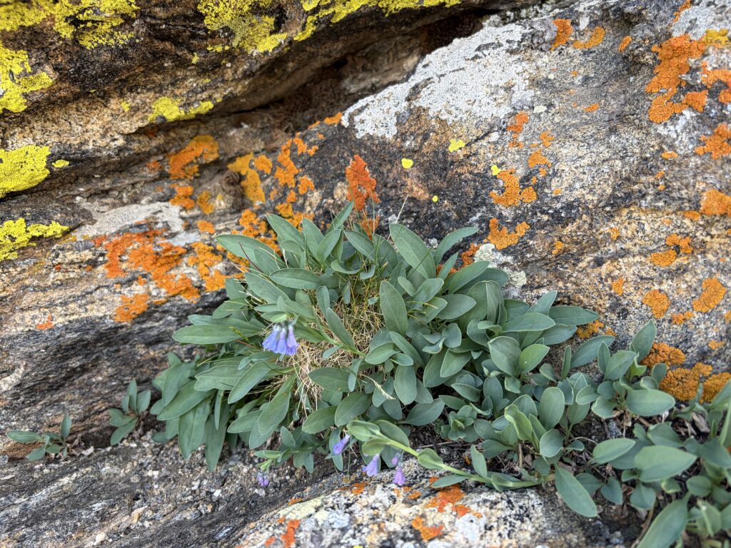
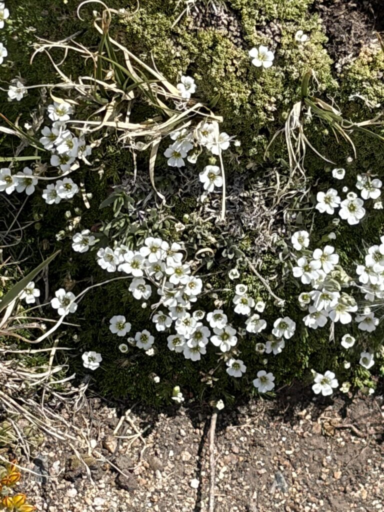
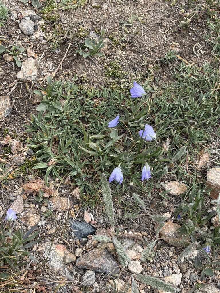
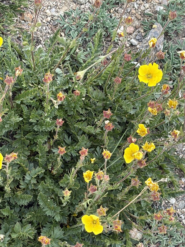
The road descends a bit from the visitor’s center, than climbs again to the top of a mountain covered with rock scree and tundra—where I was assured of seeing ptarmigan and pika (pie-ka). Climbing the trail to the top, I was entranced by the alpine flowers:
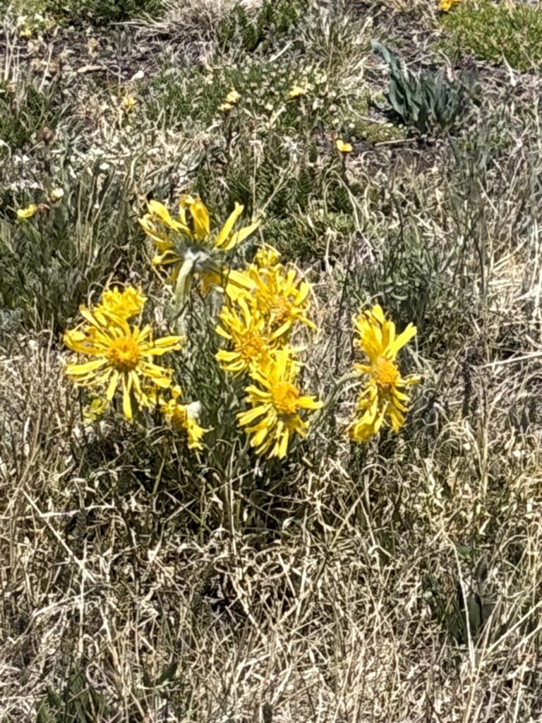
I was informed that alpine sunflowers (below) can grow for 70 years or more before they amass enough energy to flower and put out seeds—after which the plant dies.
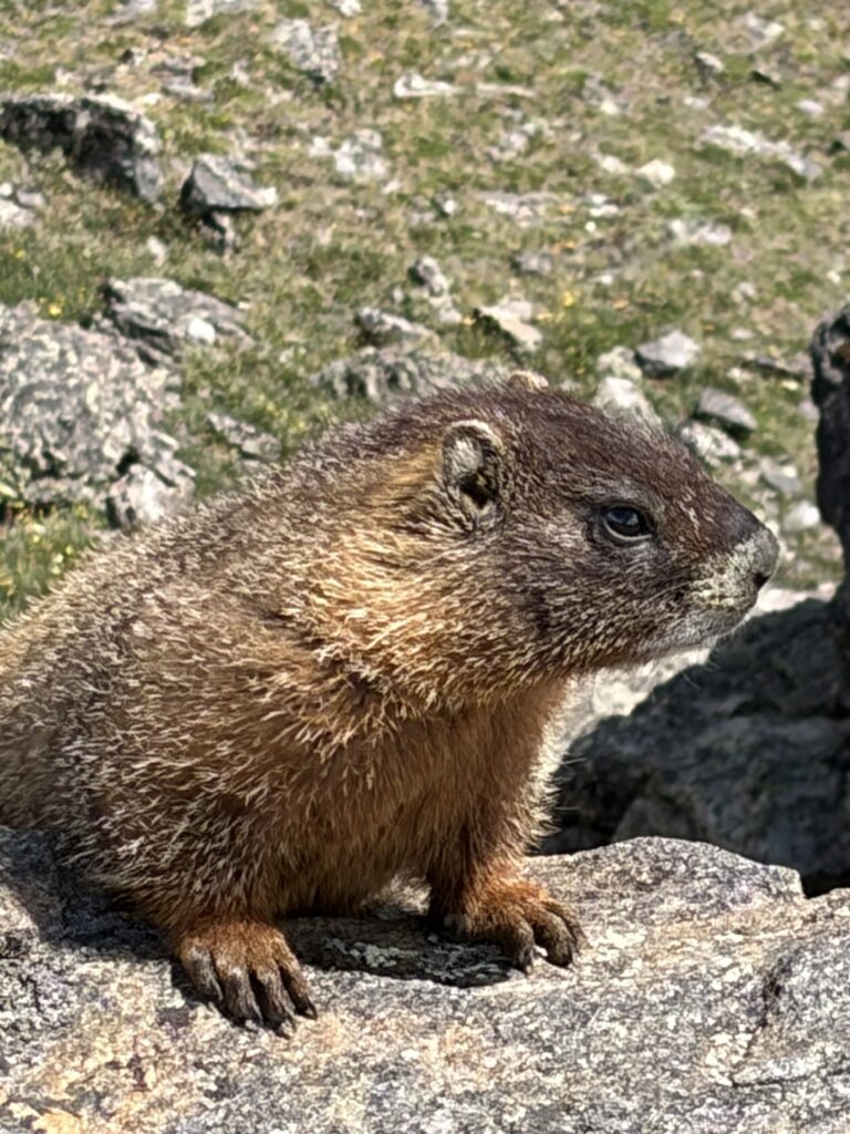
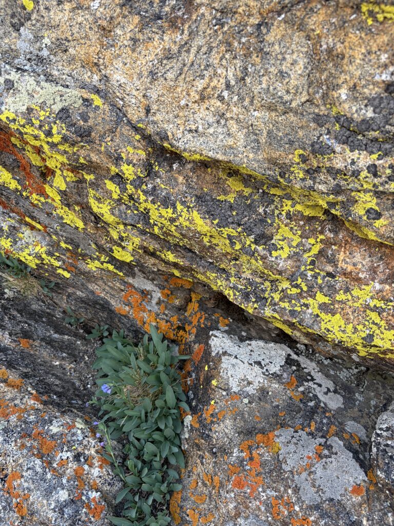
No ptarmigan showed up, so I was busy admiring some very colorful lichens, when this friendly yellow bellied marmot waddled up to within four feet of us:
Ain’t he (or she) cute?
The lichen were striking. I’ve only seen colors like this at high altitudes.
We did finally get to see pika, those chinchilla-sized rabbit cousins who make their homes in rock piles up in some of the most inhospitable environments imaginable. They spend the short (6-8 week) growing season eating and gathering alpine plant material for their underground burrows, where they will spend the long winters insulated by deep snow. Unfortunately, I could not get a shot of the fast-moving critters as they scurried about in the rocks just below the parking lot. One lone chipmunk managed to run right under Moe’s nose: I barely prevented him from launching himself off the retaining wall and right down the rocky slope. At 14, catching a chipmunk is still on his bucket list.
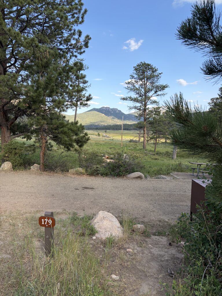
Even without the ptarmigan, it was an amazing day. And how can you beat that view from our campsite?
Sigh. Sometimes between navigating, driving, shopping, setting up (or breaking down) camp, seeing awesome sights/animals/landscapes, etc., I just don’t have the mental energy to compose my blog. Russ makes a point of doing it every night, and for that, he has my admiration.
So if you want the up-to-the-minute pics and accounting of our trip, go to russloomis.com and enjoy his excellent photography. (I’m usually driving, so most traveling pictures are his. I’m too busy reassuring him—repeatedly— we’re on the right road and trying to keep the car from straying within a foot of the white line so he doesn’t panic and think we’re about to plunge off a cliff to actually look around.)
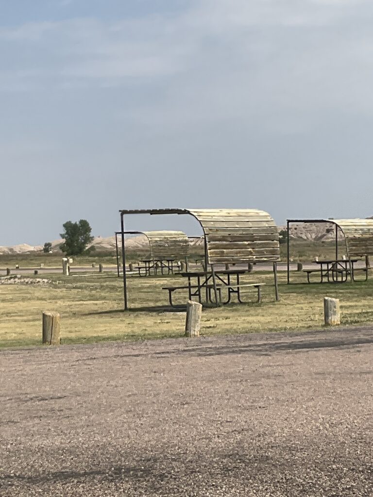
Where was I? I think my last post might have been all the way back in New Mexico. (Actually, I checked and I did post from our first campground in Colorado.) Meanwhile, we’re at Badlands National Park in South Dakota, where I’m currently sitting in the shade of a maintenance shed, watching several adolescent meadowlarks, two cliff swallows, the occasional mountain bluebird, and one very cheeky magpie forage about our campground (even the birds stay out of the sun by staying in the shade of the picnic shelters).
Ubiquitous western park picnic shelters.
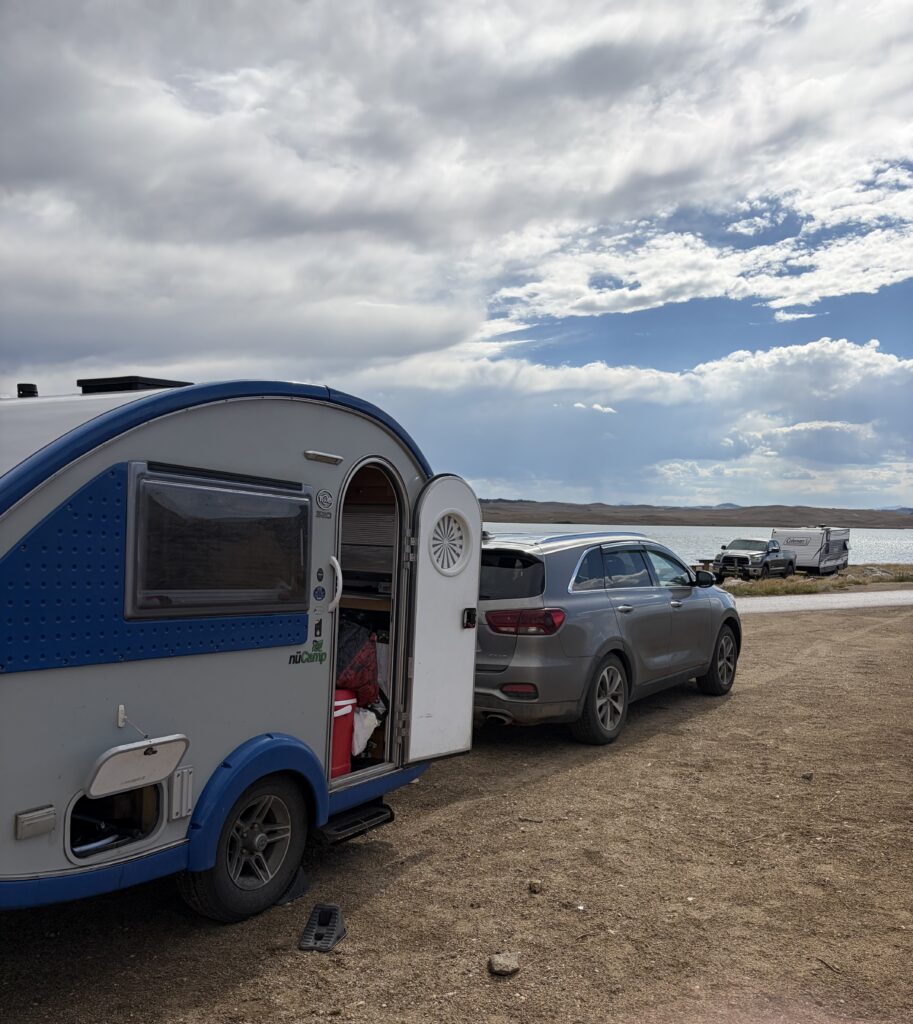
After Aspen Glade, where we decided to skip a national park just to enjoy two more nights of cooler temperatures, we made the trek to Eleven Mile State Park in Colorado. Although we were back in hot, treeless territory again, it did cool down at night. Hot daytime temps meant that we needed the pop-up tent for shade. High winds meant that we needed multiple extra tie-downs (same with Russ’s tent). It’s a wonder I didn’t break a leg negotiating all the pegs and ropes. Moe, who can’t see, kept walking into them.
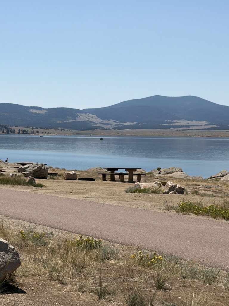
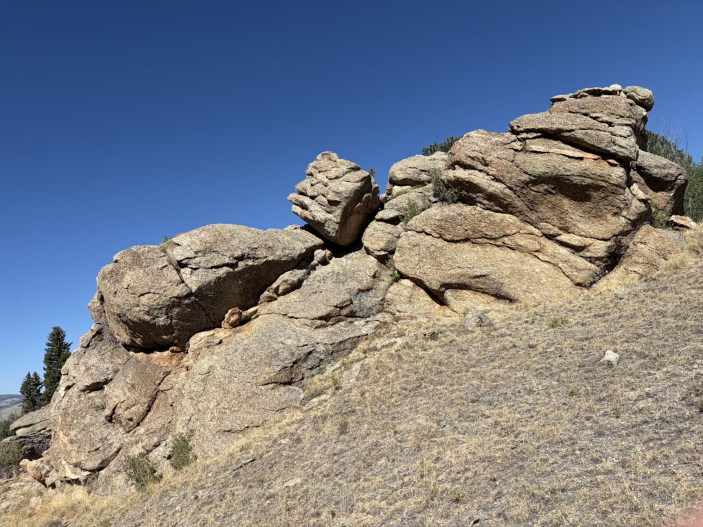
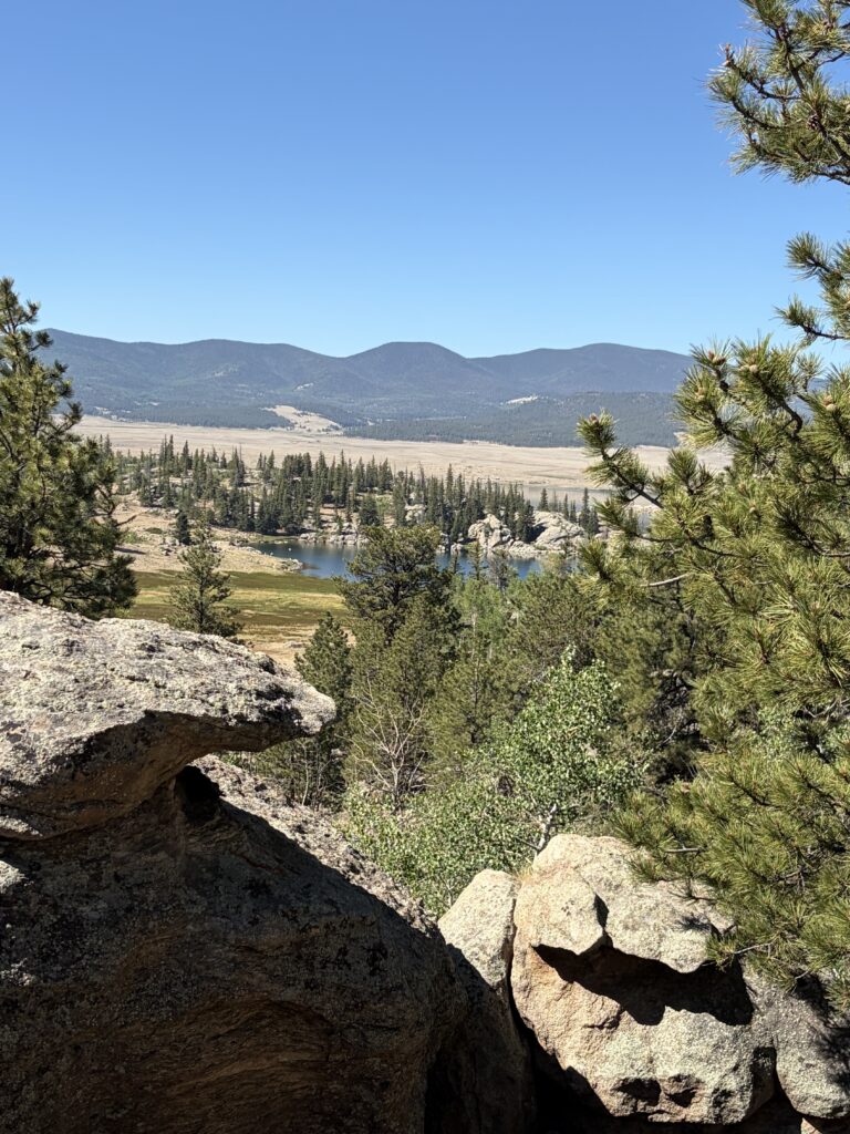
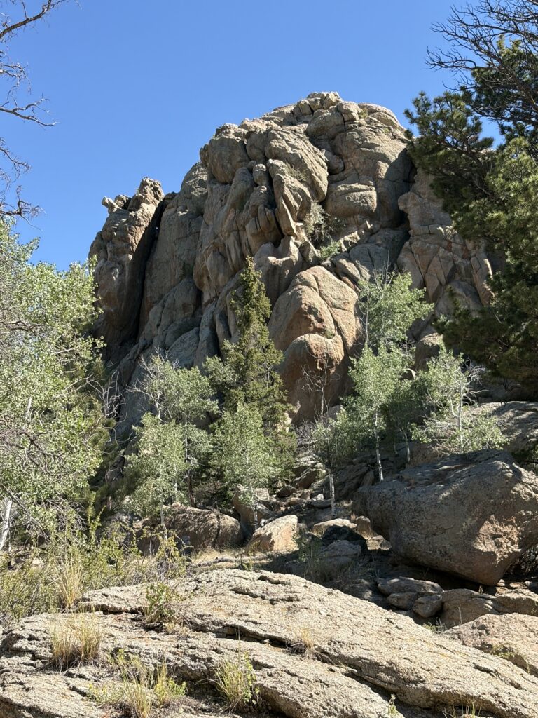
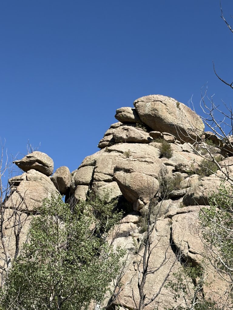
To my mind, this campsite redeemed itself with its two walking trail loops which took you up through stands of aspen and juniper and around some impressive rock formations.
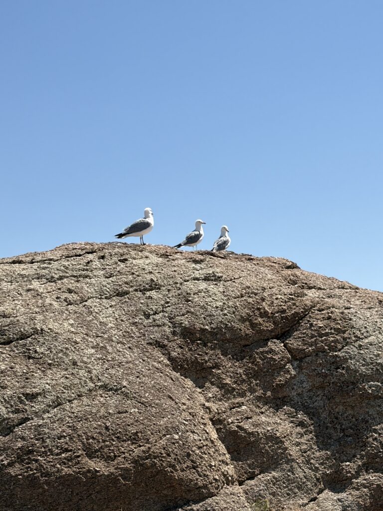
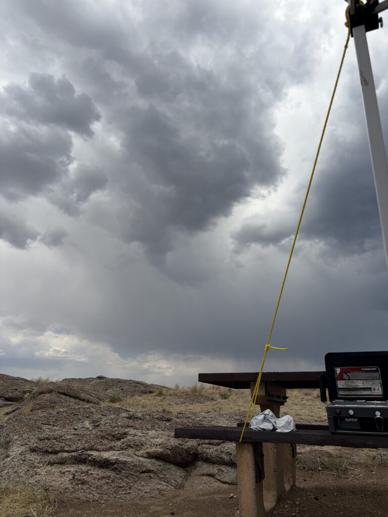
Eleven Mile Park campsiteEleven Mile LakeCurious seagullsStorm brewingLovely sunsetsStart of hiking trailHow do those rocks not fall?Views from the topA natural caveMore rock formationsEtc. (the West specializes in these)
Also a positive, I saw my first Western Grebes on the lake!
We needed one overnight stop to break up the trip from Navajo Lake to Great Sand Dunes National Park, but I’d been unable to get a reservation anywhere. So we set out for the Rio Grande National Forest, hoping to get a first-come first-serve campsite at one of the several campgrounds scattered along the Conejos River. We were just hoping for any campsite but boy, did we find one at Aspen Glade!
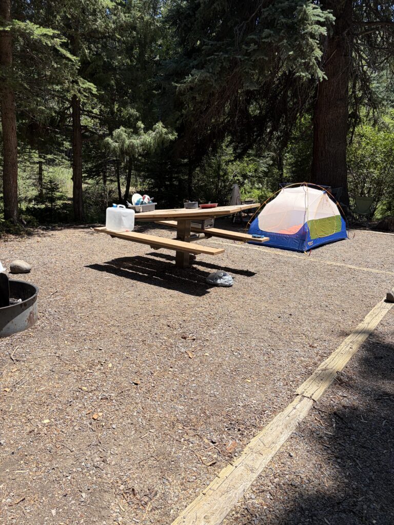
Beautiful site, right on the river, plenty of shade and trees for Russ to hang his hammock from (he’s become very fond of sleeping out in his hammock, while I don’t mind getting the whole bed to myself and Moe).
Alas, it was only for one night—it actually was a reservable site and someone had booked it the next day. Our second spot wasn’t quite as spectacular, but by this point we were enjoying the shade and the cool breeze so much that we decided to skip Great Sand Dunes altogether and spend two more nights there.
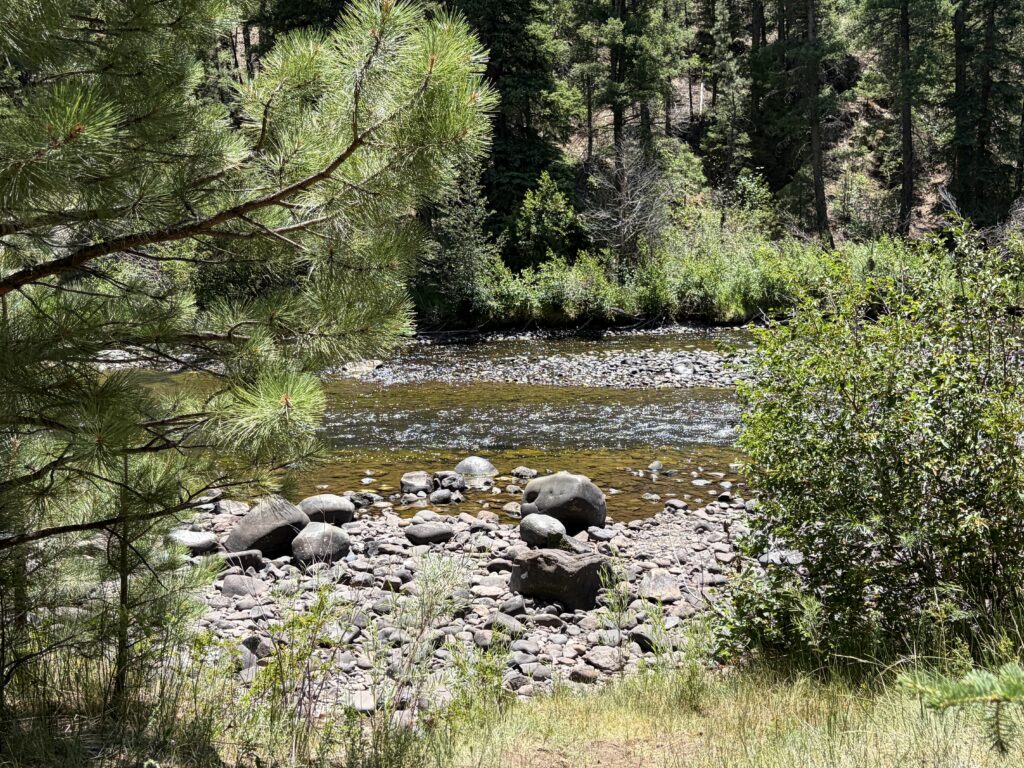
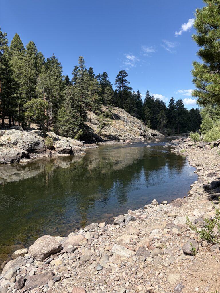
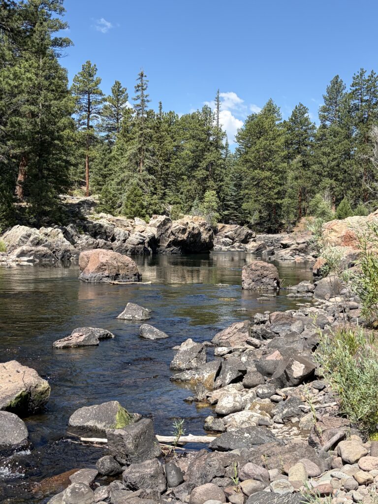
Shortly before we arrived, a big Ponderosa pine fell across this site, bashing the picnic table. But it was almost on the river and we had shade. When we weren’t relaxing and enjoying the cooler air, we were hiking along the Conejos River and taking pictures of the spectacular scenery.
The other great thing about Aspen Glade was the birds. On top of Western Tanagers—vivid yellow and black birds with bright orange-red head and Steller’s Jays—big, boisterous, bold birds much like their Blue Jay cousins, but with striking blue and black coloration—both of which I’ve seen before, I actually added three new birds to my life list! I was delighted to spot Juniper Titmice, Mountain Chickadees, and a lone Pygmy Nuthatch. Broad Tailed Hummingbirds often flashed by, hovering in front of anything colorful—pink shirts, blue waterbottles, even Moe’s red collar, which left him alert but confused.
We made the right choice, according to our neighbors, who visited Great Sand Dunes only to be hit by a sandstorm. The campgrounds, they said, had no shade at all. Three nights well spent cooling off after our very hot visit to New Mexico. It was worth it, even though it made a long trip to our next campground at Eleven Mile State Park.
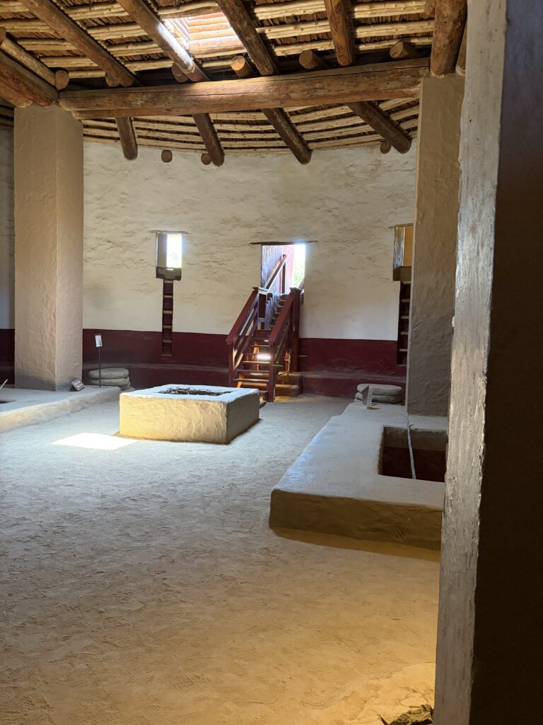
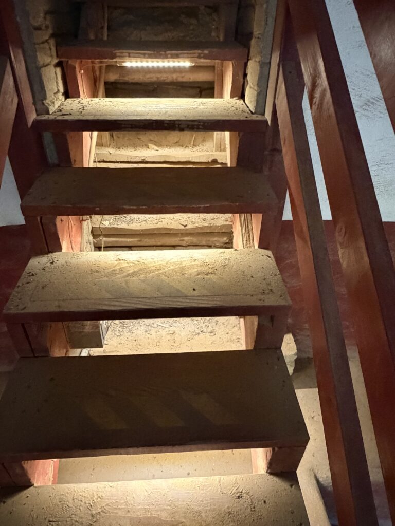
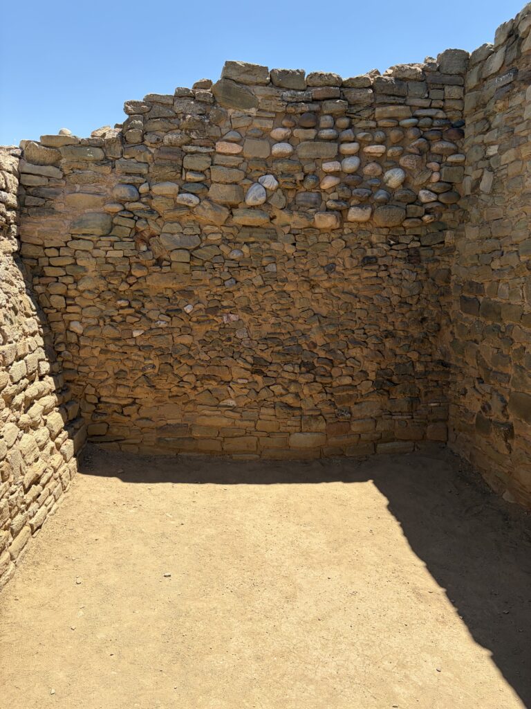
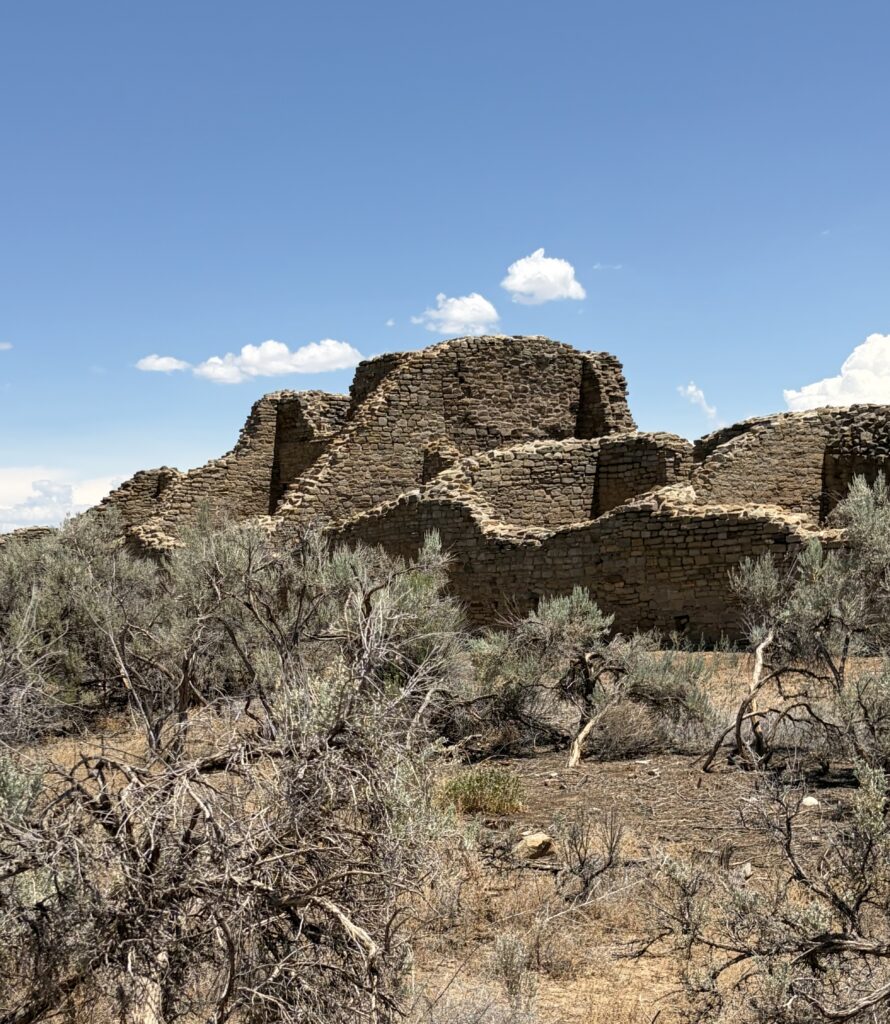
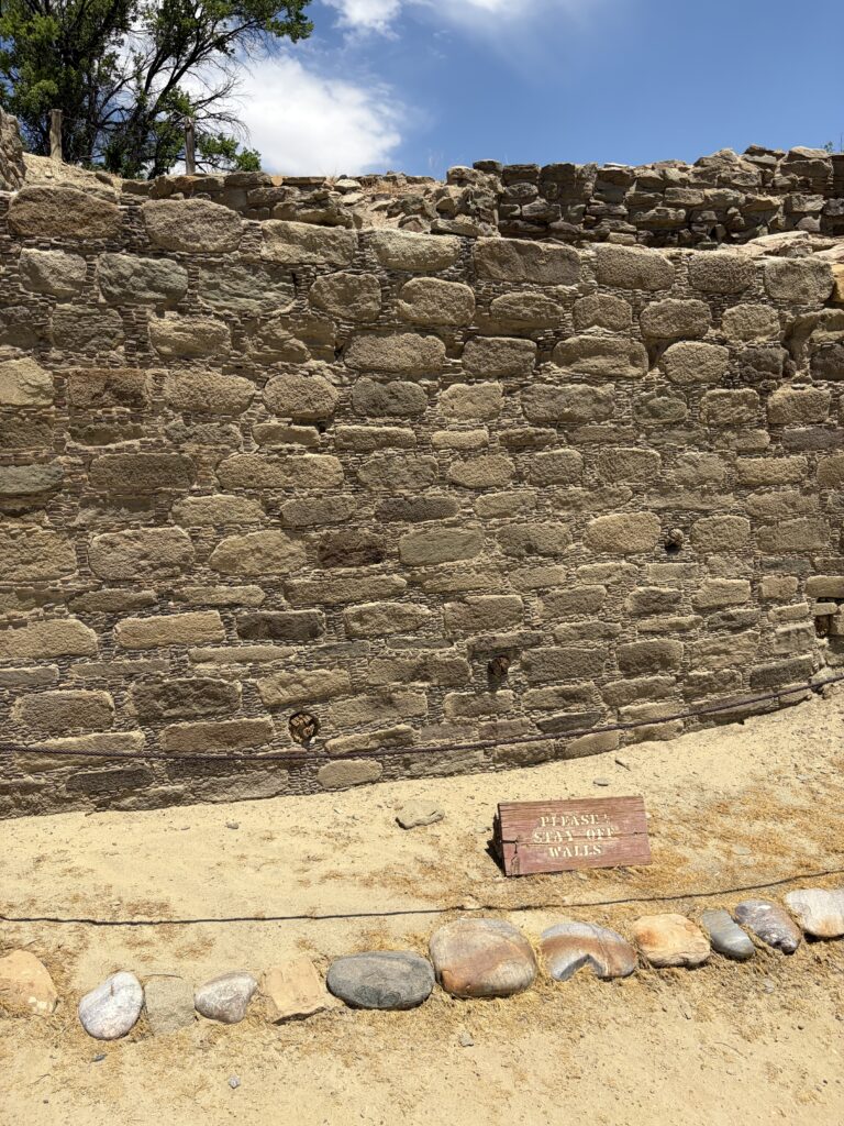
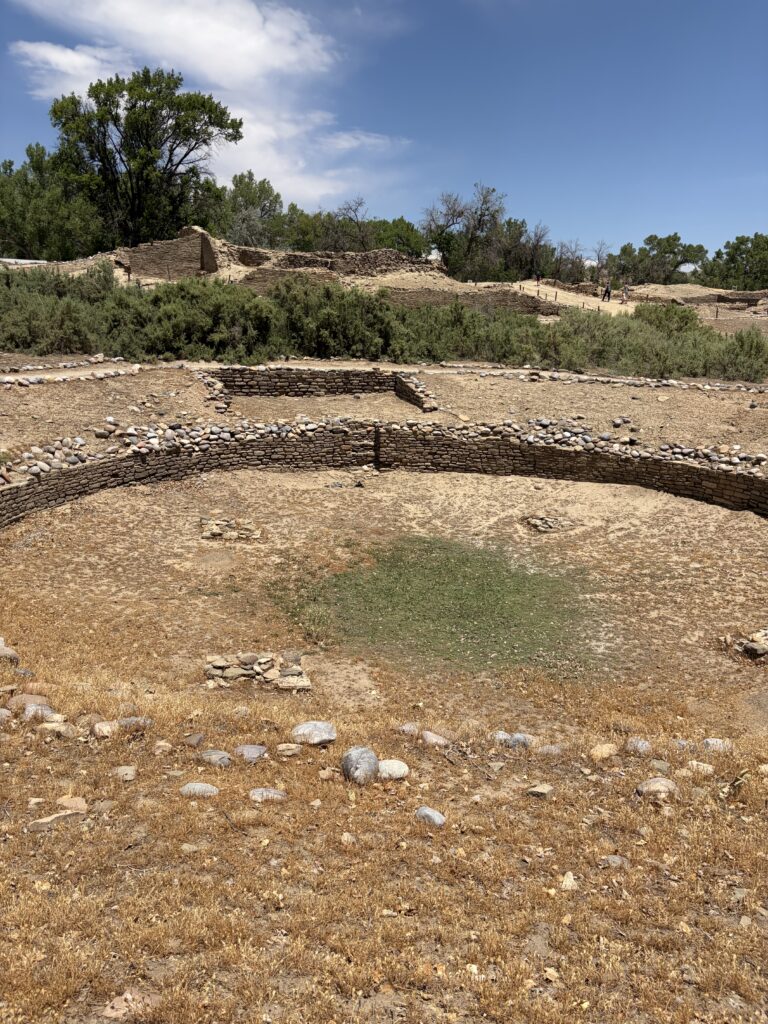
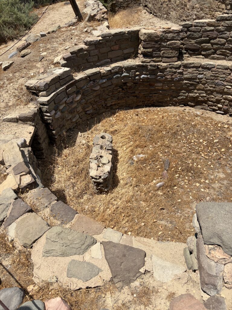
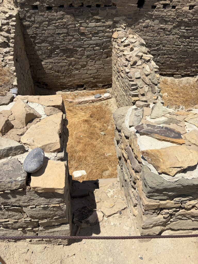
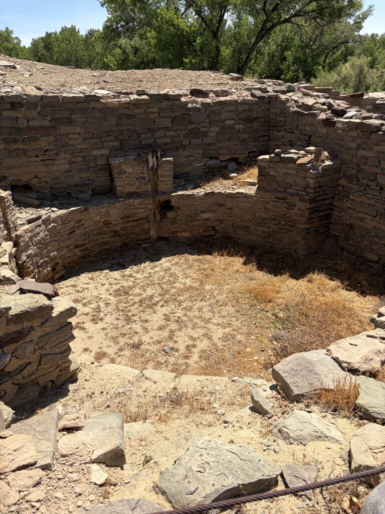
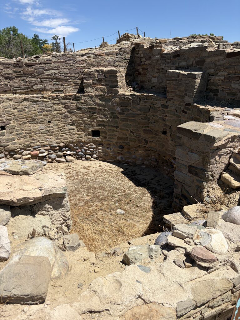
The next day, we visited Aztec Ruins, a well-preserved Ancestral Puebloan ruin even larger than Salmon. I got way more pictures here, (probably because I was not dealing with the emotional overload of yesterday). At Aztec, the original archaeologist undertook to restore the main kiva in the 1930s. While one could question the authenticity of his restoration, there is no question that this kiva is awe-inspiring. As with most kivas, you descend from ground level down ladders or steps into the kiva space.
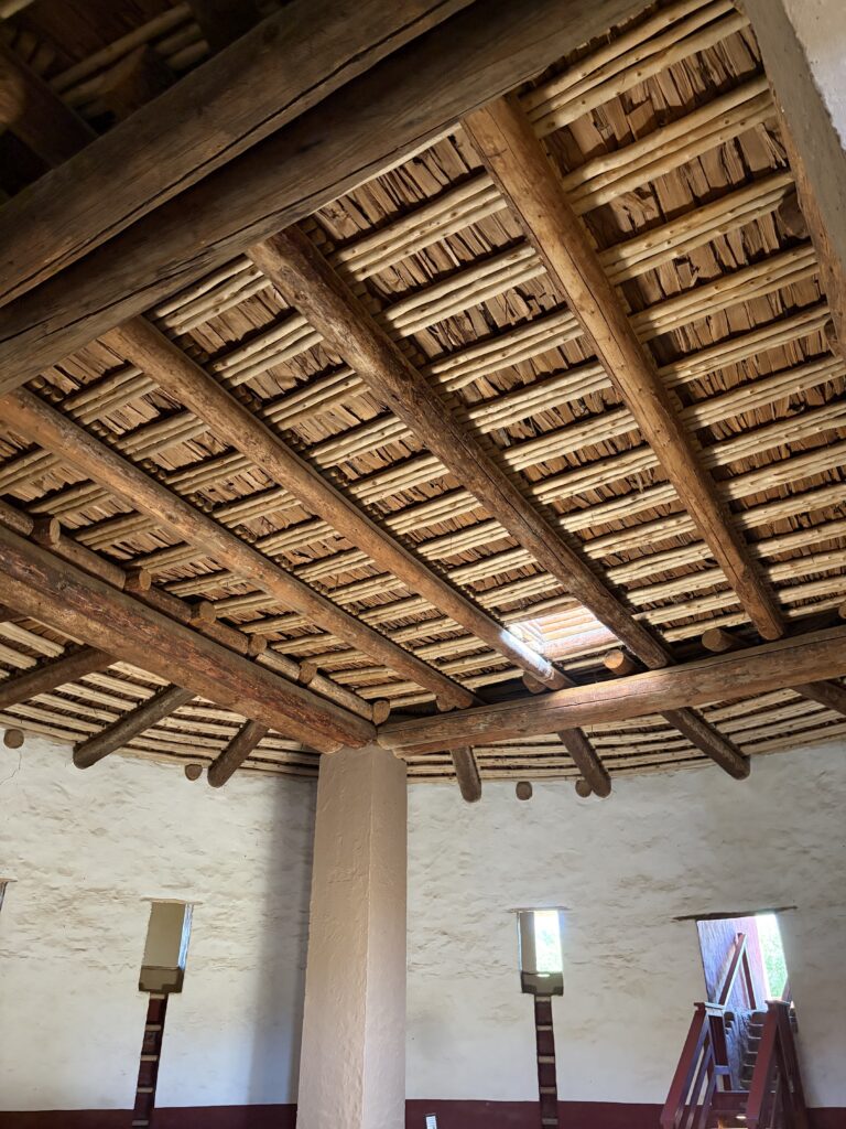
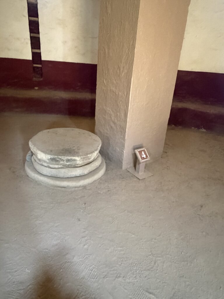
Inside kiva, looking back to main entranceReconstructed flat kiva roofReconstructed pillar, with original foundation stonesYou can see the original stone steps below the new wooden onesOutside room, looking into kiva
This kiva had two unusual features—one, across from the main entrance, a separate set of steps led to an upper balcony-type area, open to the kiva. Second, it was encircled by small rooms at ground level, which gave access to the kiva via ladders built into the walls. What their purpose was is uncertain, although they might possibly have allowed families or clans their own entrance—or have allowed celebrants or performers to enter from different places.
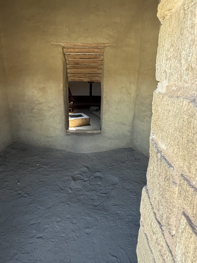
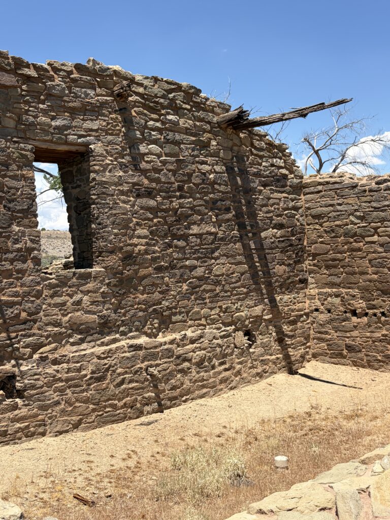
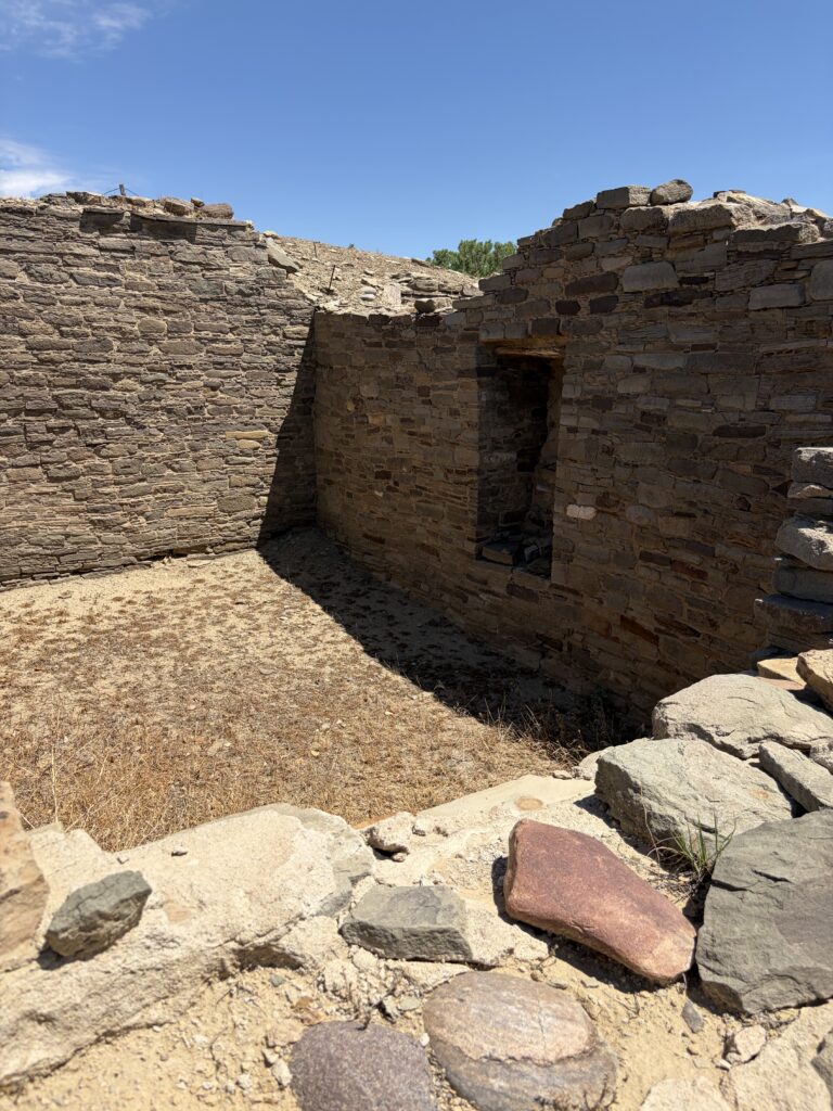
Aztec Ruins also allowed you to enter the Pueblo rooms themselves, to experience what it would have been like living there. Front rooms entered onto the main plaza, and they would have been where much of the work was done, as they had the best light. Moving back through three or four rooms to the back wall of the Pueblo, you would have moved from living areas to storage areas at the far back, where there was the least light.
A rare 4-way doorwayT-shaped doorway, a common design elementRemains of a rush mat to divide rooms. It still hangs here, 800 years laterIntact ceiling, showing the cross beams and adobe floor of the room above
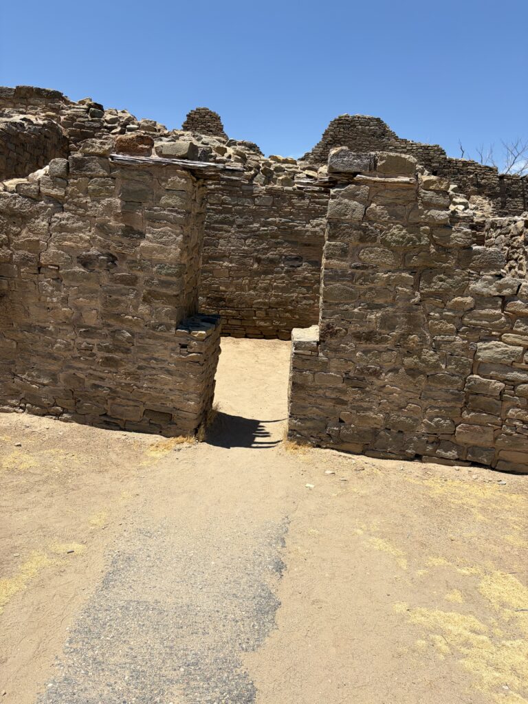
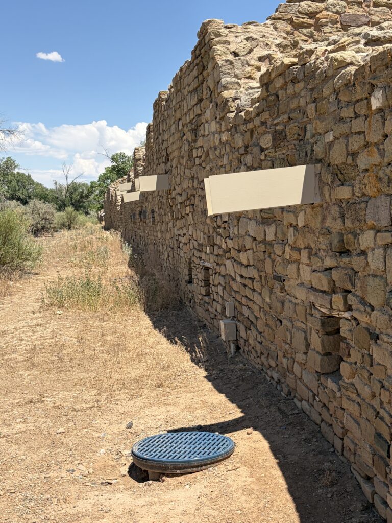
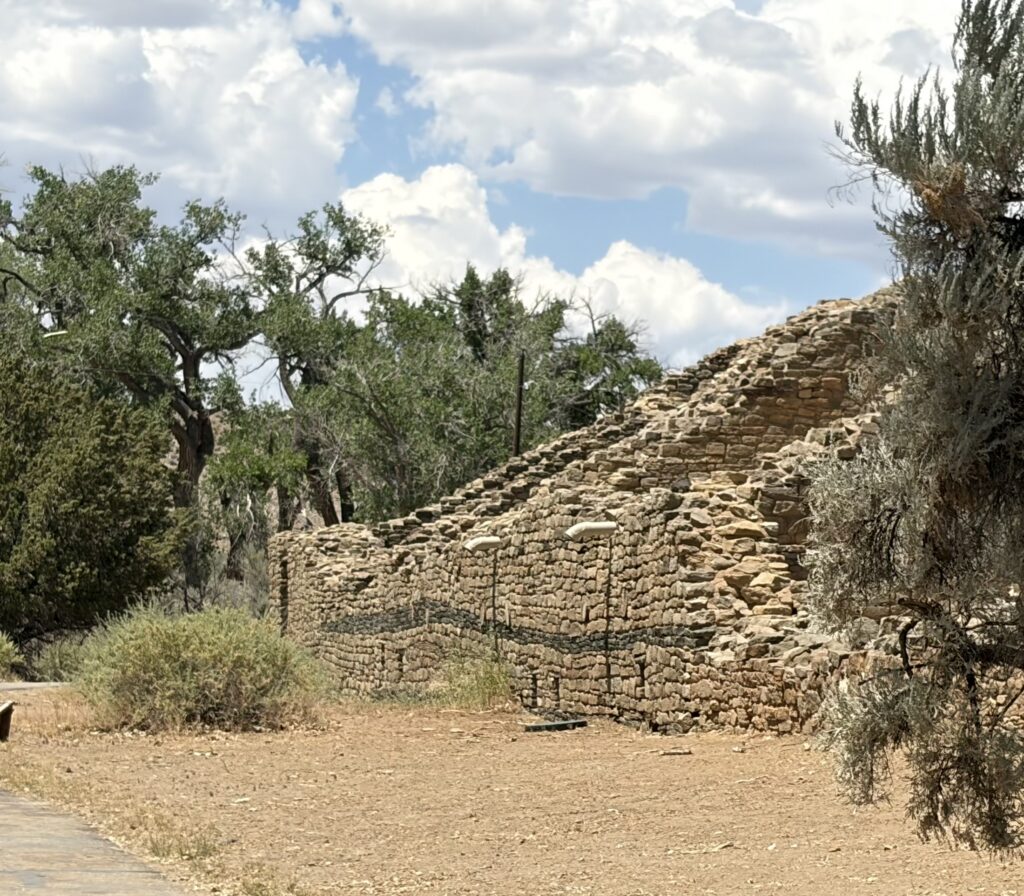
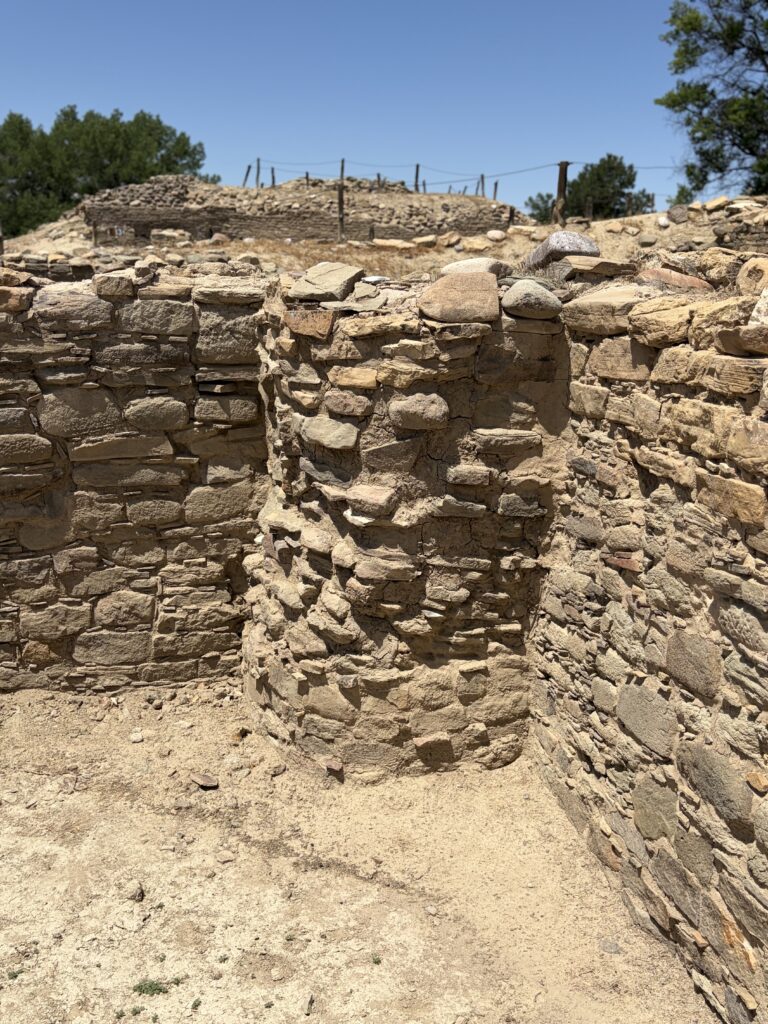
Beside Aztec Ruins (west) is another large Pueblo (Aztec East) which has never been excavated. It was the more heavily looted site; now it remains unexcavated out of respect for the descendants of its builders.
You can clearly see later repairs/building on this wall One of the kivas; remnants of the roof beams still intactThe back wall of the Pueblo is precisely aligned to the summer solstice (projections are modern drains)A rare three-walled kivaEven in ruins, it is still three stories high
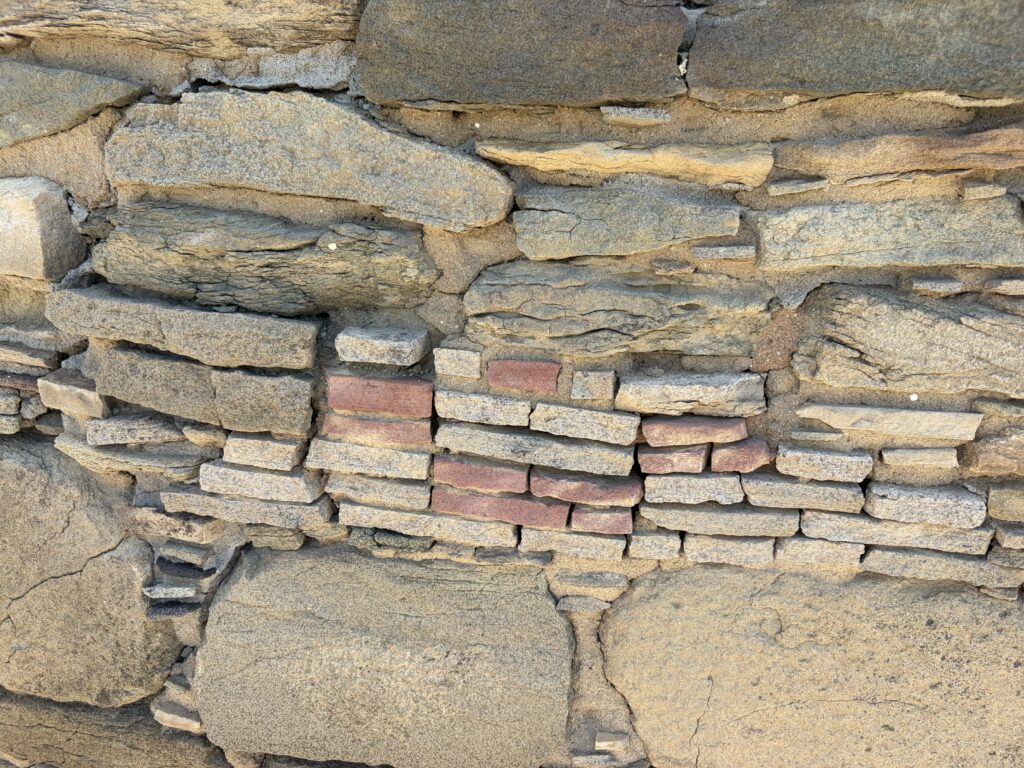
A striking feature of Aztec is the decorative band on the west wall, made from set-in green stones.
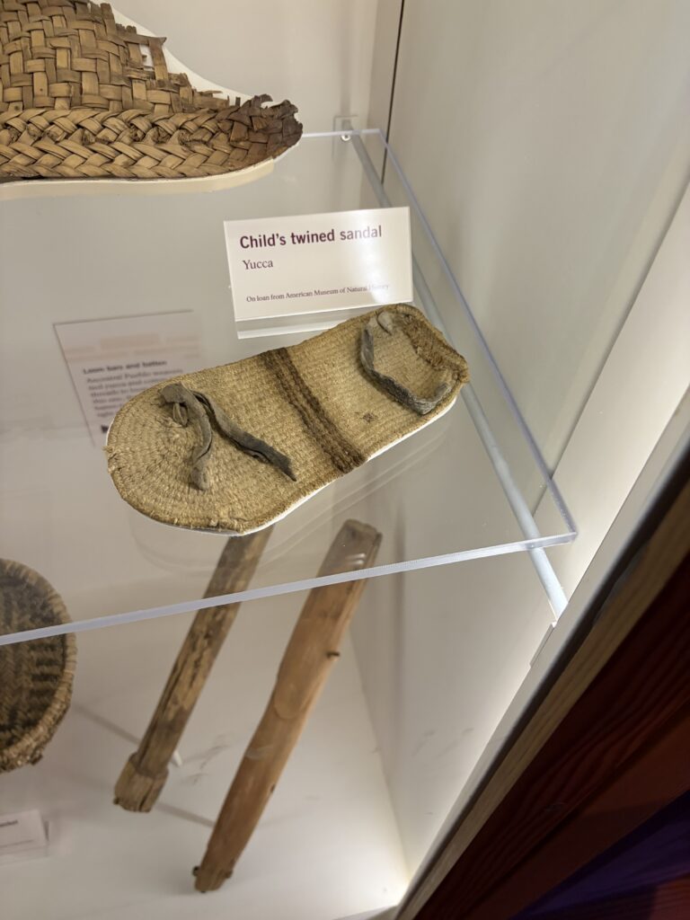
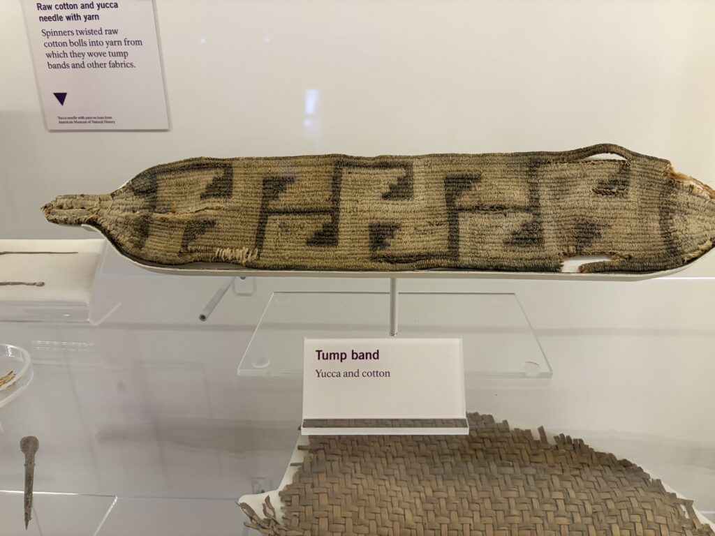
The original excavation in the 1930s had been done under the auspices of the American Museum of Natural History, but that institution has “loaned” many artifacts back to the museum at Aztec. I was particularly interested in woven objects, as they tend to be rare (fibers do not preserve as well as stone or ceramic).
:
Child’s sandalWoven tump band, worn across the forehead to support loads on one’s back
Somehow I had not been aware of Aztec Ruins when I was working at Salmon, even though we visited several of the Ancestral Puebloan sites in the area. I was very glad we made the visit, even though we were definitely hot and cranky at the end. Moe, as usual, hung out in the air-conditioned car while we were gone, but was none the less miffed by our absence.
That evening, after a much-needed shower, I had a delightful time doing show and tell with a fellow stitcher, and we talked quite late into the evening.
In the summer after my junior year in college, I had the opportunity to be part of an archaeological dig at Salmon Ruins, near Bloomfield, NM. My college major was anthropology; my primary interest archaeology. I was 19. I had never been west of Detroit.
I was so excited and nervous to revisit the dig that I barely slept the night before. I even, after some hesitation, reached out to a man I’d had a summer romance with that year. He had gone on to a long and distinguished career in archaeology, and now resided in Arizona.
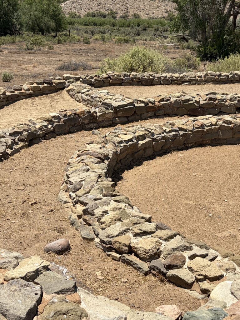
I knew the site would be different, but it was so changed that I had trouble orienting myself at first. There was an entire area, the Heritage Trail, added to the ruins to show the history of the area, and especially the story of the Salmon family, the first white settlers there, who were instrumental in preserving the site for future generations. The housing development encircling the site was especially disconcerting. Many of the rooms and kivas had been partially or wholly backfilled, to stabilize crumbling walls. And of course, the plaza and main kiva had not even been excavated in 1974.
But eventually, I recognized some of the areas I’d worked on. And I chuckled to see that the crew housing was virtually unchanged. Leaving Moe in the car with the ac on, we set out around the site.
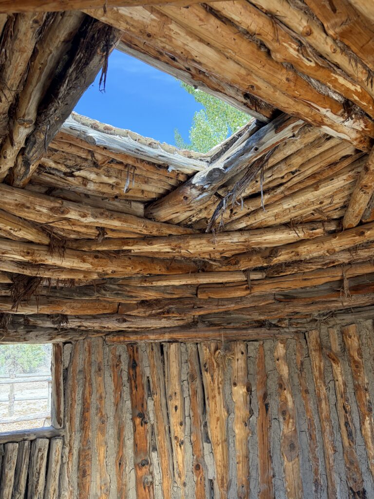
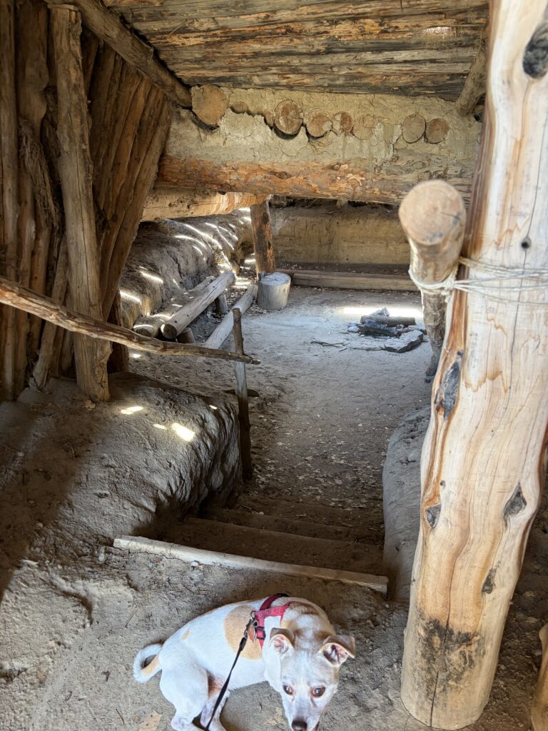
Women’s hogan; note roof structurePartially underground house; an earlier dwelling form Women’s hogan, looking in from entrance
Moving onto the ruins:
Outer wall of the puebloCentral ‘Great’ KivaTower kiva in center of puebloVentilation shaft; this pueblo was 3 stories in placesPueblo roomLarge room, probably a communal work areaSmall portion of a wall mural; red color is made by placing stones in an oxidizing fire
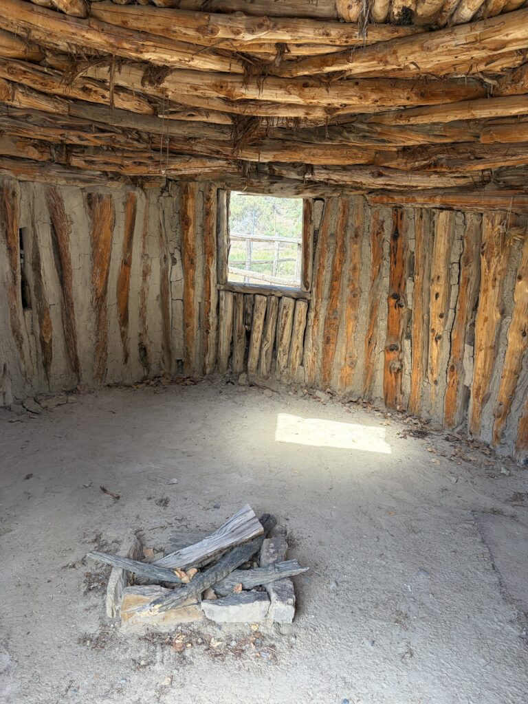
And then I finally found the small kiva I’d worked on and my 19-year-old self came flooding back.
Oops—this is a different kiva!
This had been backfilled: in 1974, the floor was several feet lower.
Returning to the museum (the director graciously waived my entrance fee), I was told that the retired director, a man named Larry Baker, was in the library: he had also been on the dig in 1974. We chatted about those days and some mutual acquaintances, but neither remembered the other from that summer. I left feeling a multitude of emotions.
And my gentleman friend from that summer? Kurt wrote me back that very evening. He told me a bit about his career and his current work, and told me he remembered that summer—and me—fondly. Just for a minute, I was 19 again. For a 72-year-old, that’s pretty heady stuff.
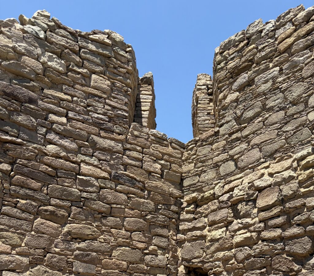
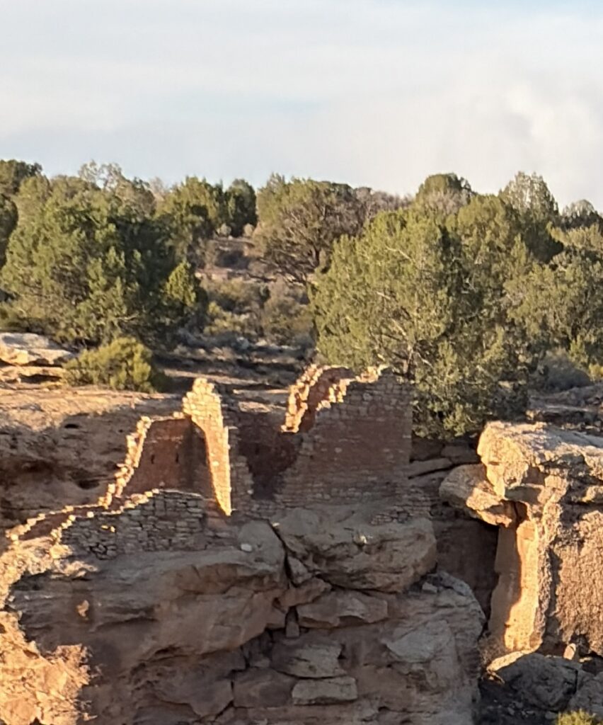
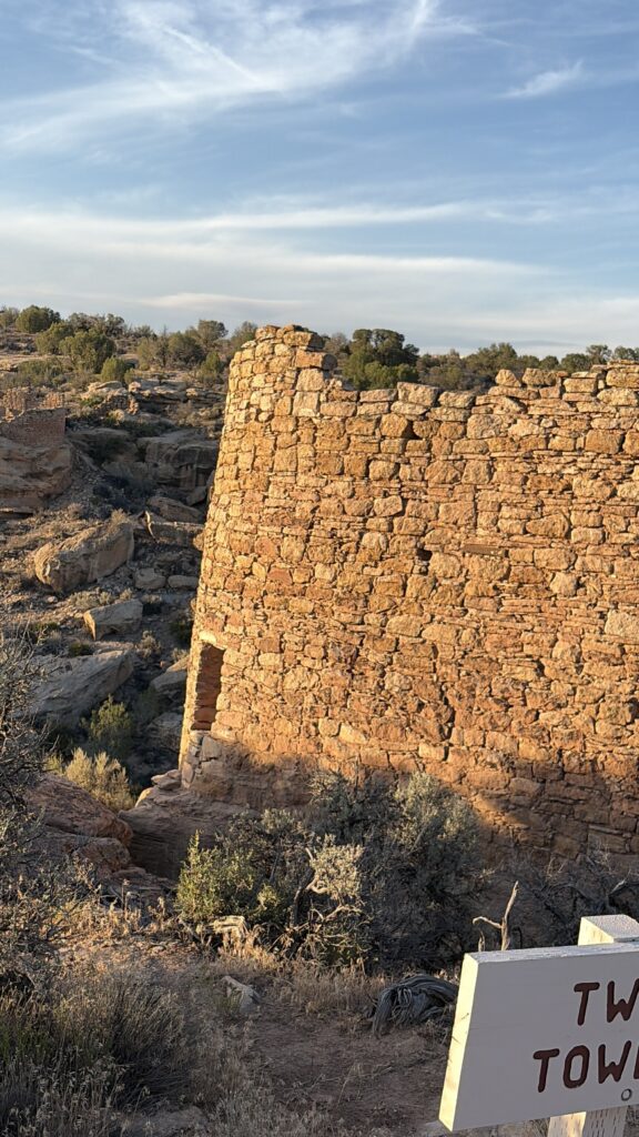
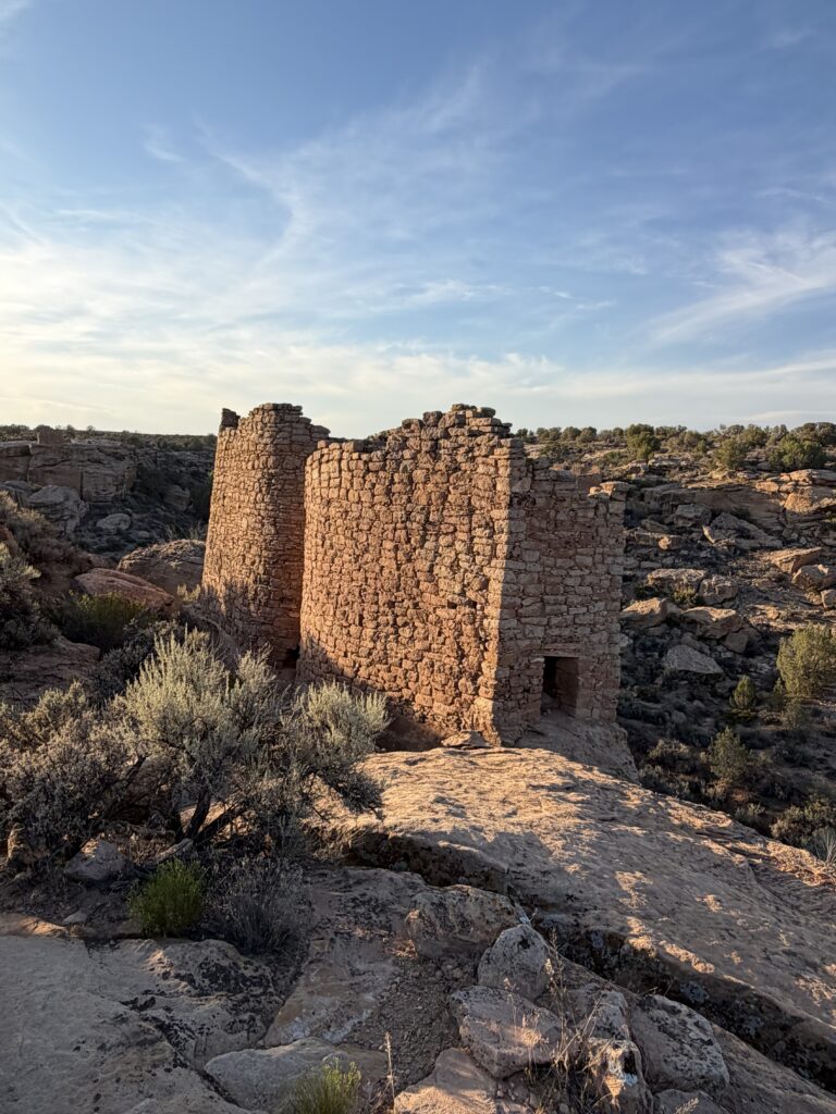
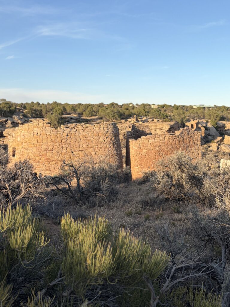
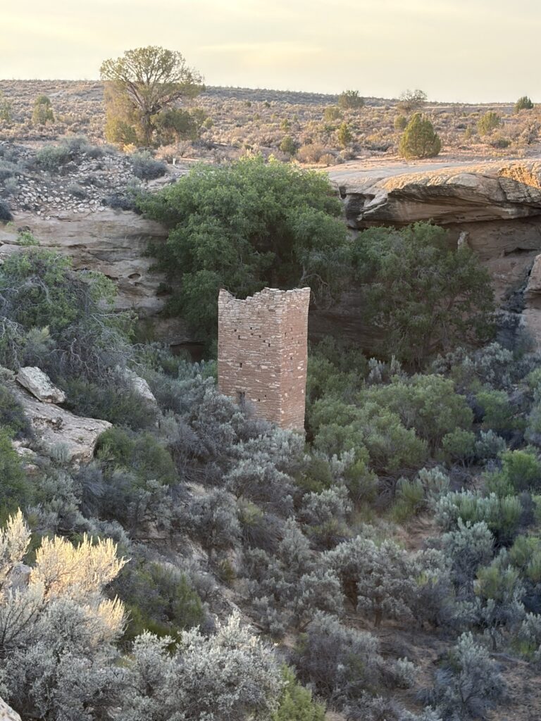
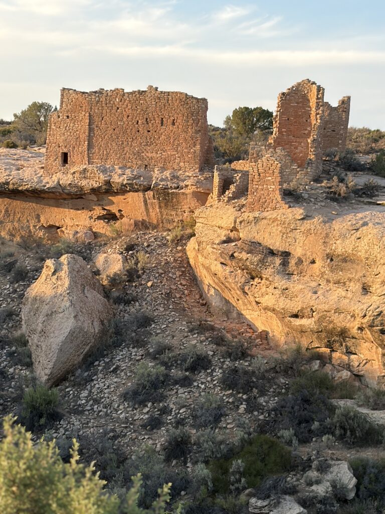
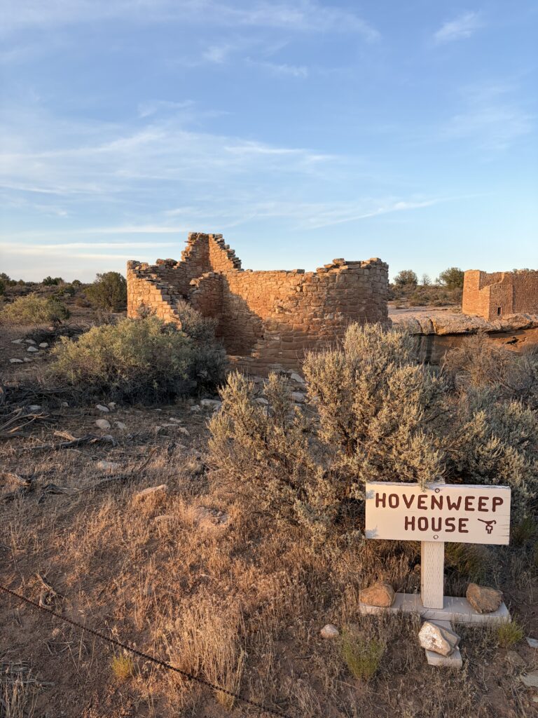
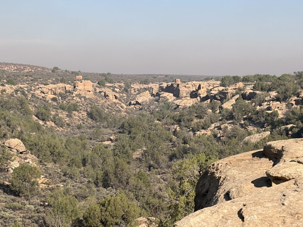
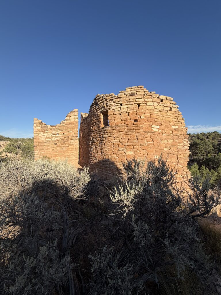
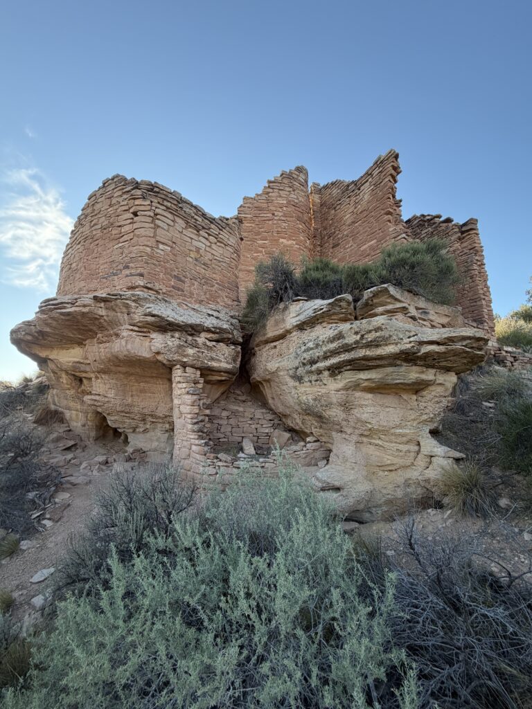
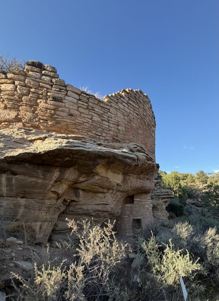
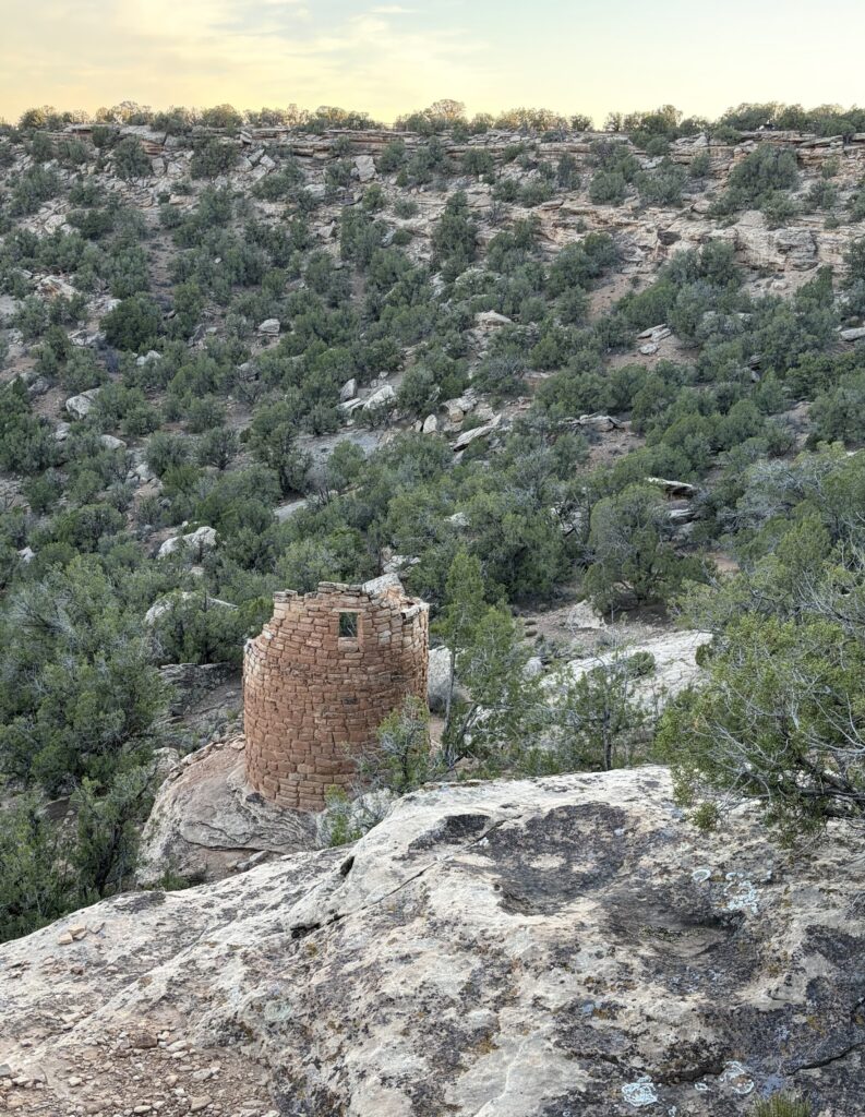
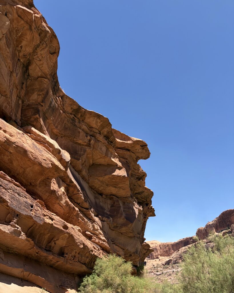
Hovenweep was not on my radar back in my archaeology days, but it is, in fact, not far from the Four Corners area, just north on the Utah/Colorado line. There is a central cluster of ancestral Puebloan ruins in a canyon close to the campground, plus a few outlying sites nearby. It’s also on the border of the Canyons of the Ancients National Monument, which encompasses over 100,000 acres and some 2,000 ruins in all.
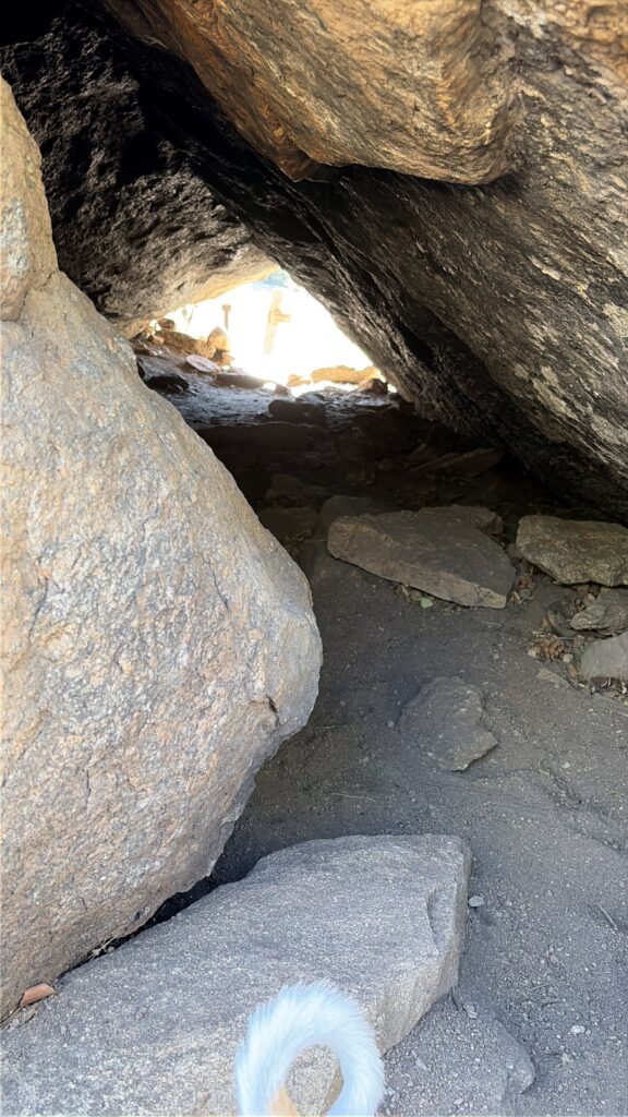
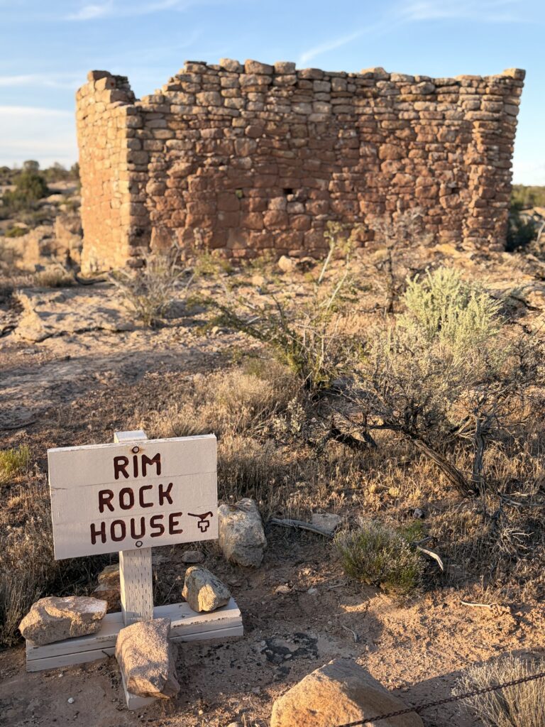
These structures circle the end of a smallish canyon, which had a water seep at its terminus. Some of the dwellings were clearly living spaces, such as the Castle complex and the Twin Towers. Others are mysteries: was the Square Tower, situated in the bottom of the canyon, near the water source, a defensive structure? Rimrock House, despite its name, was almost certainly not a dwelling—it has no room divisions. It does have multiple small openings in the walls. Were they for spotting people entering the canyon? Observation points for tracking the sun? Or just ventilation holes?
The Square Tower Complex was mostly built between 1230 and 1275, about the same time as Mesa Verde, and held as many as 100 to 150 people, during a time when the seep at the head of the canyon provided a steady supply of water for growing corn and other crops, which were supplemented with a variety of game.
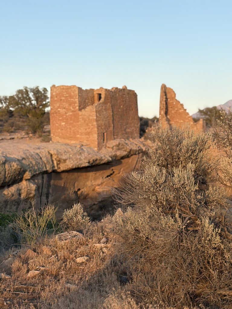
On our last morning, I chanced to find a viewpoint that showed the complex from further down the canyon. The structures glowed in the early morning sun. Can you see them? Twin towers is on the left: tower point and Hovenweep Castle on the right. BTW, the name Hovenweep was given by a white explorer, but mcame from the Ute, meaning “deserted valley.”
There are other delights in the campground, particularly (for me) the Gambels quails that forage near our campsite in the mornings. Like their near relatives the California quail, Gambels have a forward arching, teardrop shaped feather on top of their heads, which bobbles adorably as they scurry around. Moms usually take the lead, babies string along behind, and dad takes the rear guard. There are great-crested flycatchers, black throated sparrows, and even roadrunners! (but no coyotes)
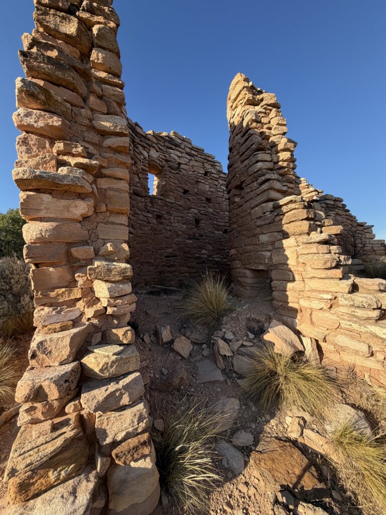
On our second day, we visited some nearby sites: Cutthroat Castle and Painted Hand Pueblo.
Cutthroat Castle from aboveCastle from belowSee the lower rooms?Painted Hand; unfortunately we could not get closer
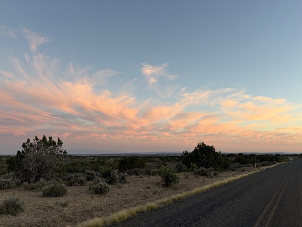
The next day (4th of July) we drove an hour into Cortez (the nearest town with actual grocery stores) for supplies and lunch. On our return trip, wildfires had moved swiftly closer, and were filling the sky to our west with gray smoke (check Russ’s blog, russloomis.com, for those pics; I was driving). I did get one shot of the beautiful sunset clouds:
All day, I’d been thinking about the contrast between the sentiments of the 4th of July and the ancient people who lived here: people whose descendants could only see the creation of the United States of America as destruction of their own country. I’d been a part of an ancestral Puebloan archaeological dig; I’d handled the objects they left behind (and carefully exhumed a grave or two). It left me in a very strange mood for most of the day.
But after our return, we joined another couple our age on the shady side of the bathhouse, sat and talked, and shared the cherries we’d bought. We swapped travel stories, interests, and family info. And I thought this is America, too: making new friends, speaking of our loved people and places, creating communities, even if only for a few days. Maybe, I thought, we just need to acknowledge that for many people, this country is a lot older than 250 years.
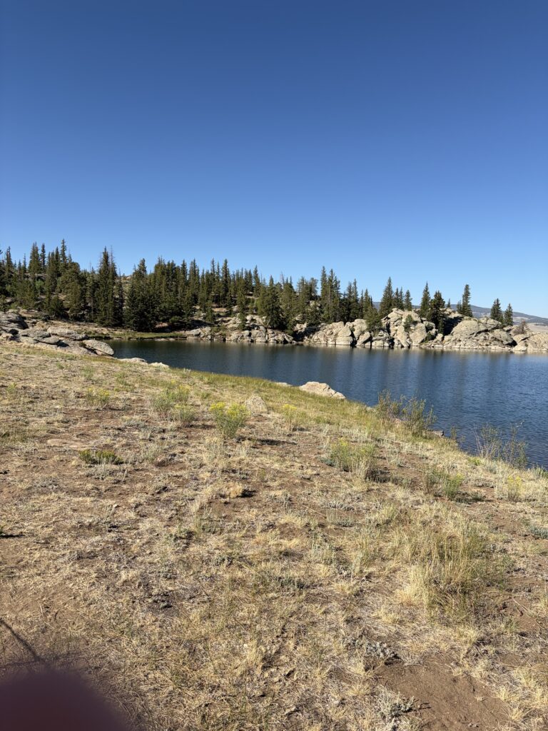
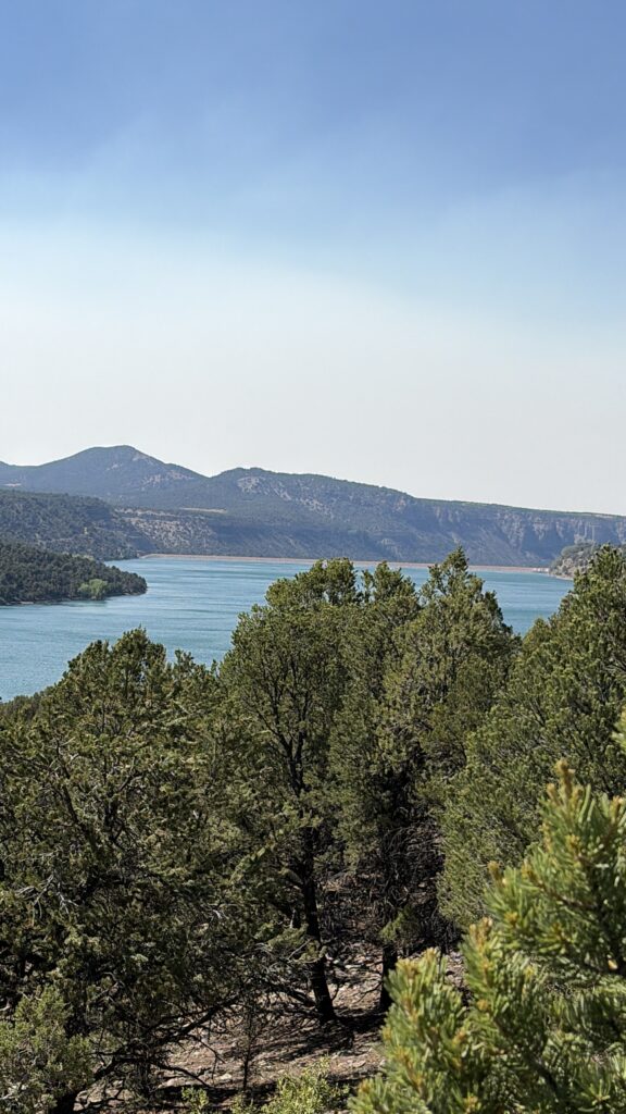
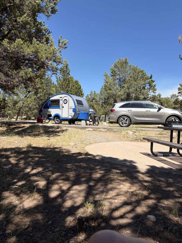
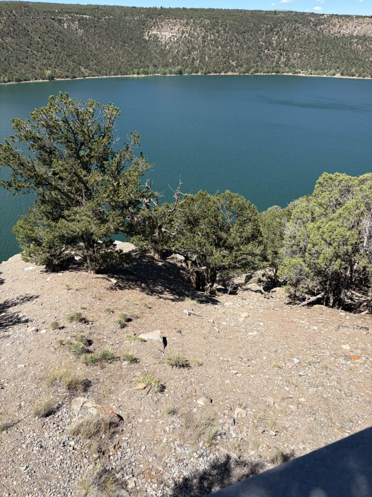
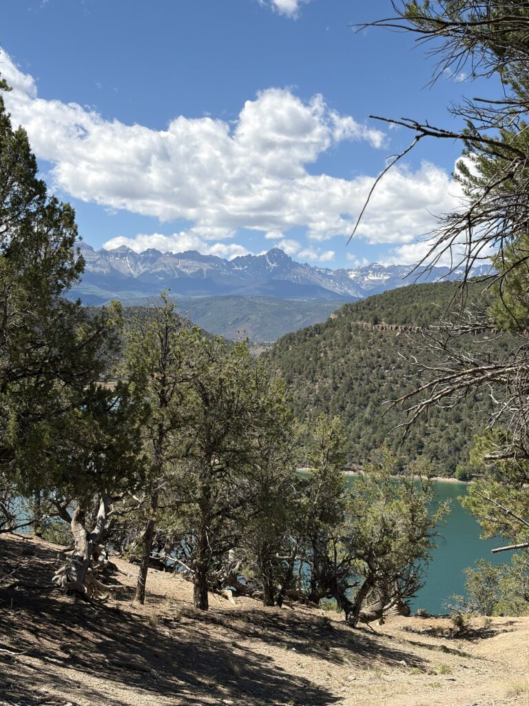
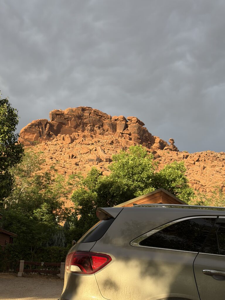
We were told this was “a must-see,” “the Switzerland of Colorado,” by our neighbor a few campgrounds back. Since Colorado, last time I looked, had plenty of impressive mountains, I was curious as to what would qualify this area as “Switzerland.”
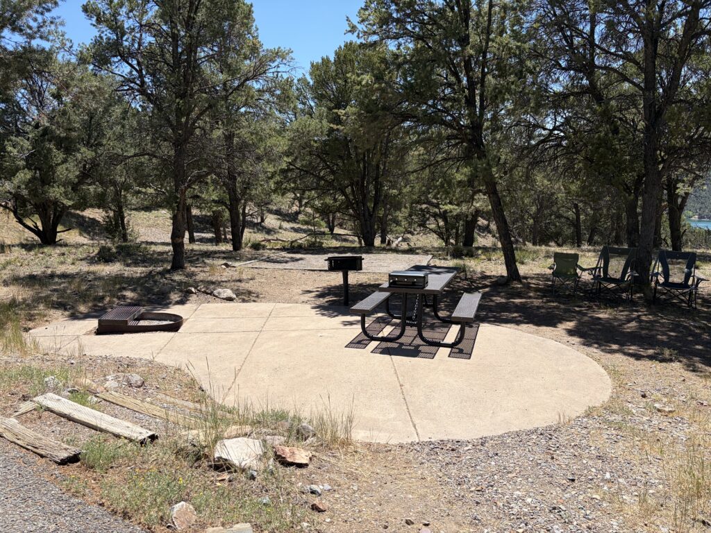
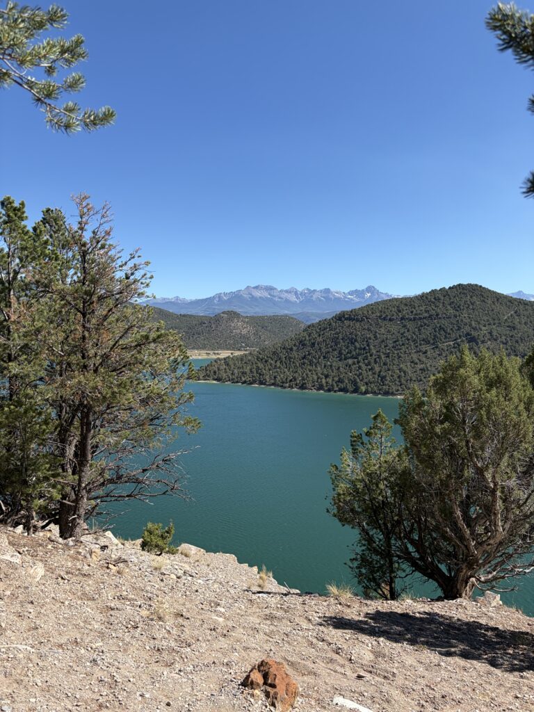
And it was delightful, though neither of us was quite sure what made it Swiss-like. The park has three distinct camping areas, plus a day-use area down on the lakeshore, with a swimming beach and boat launch. We were at Elk Ridge, high up but with great views of the lake and the surrounding mountains.
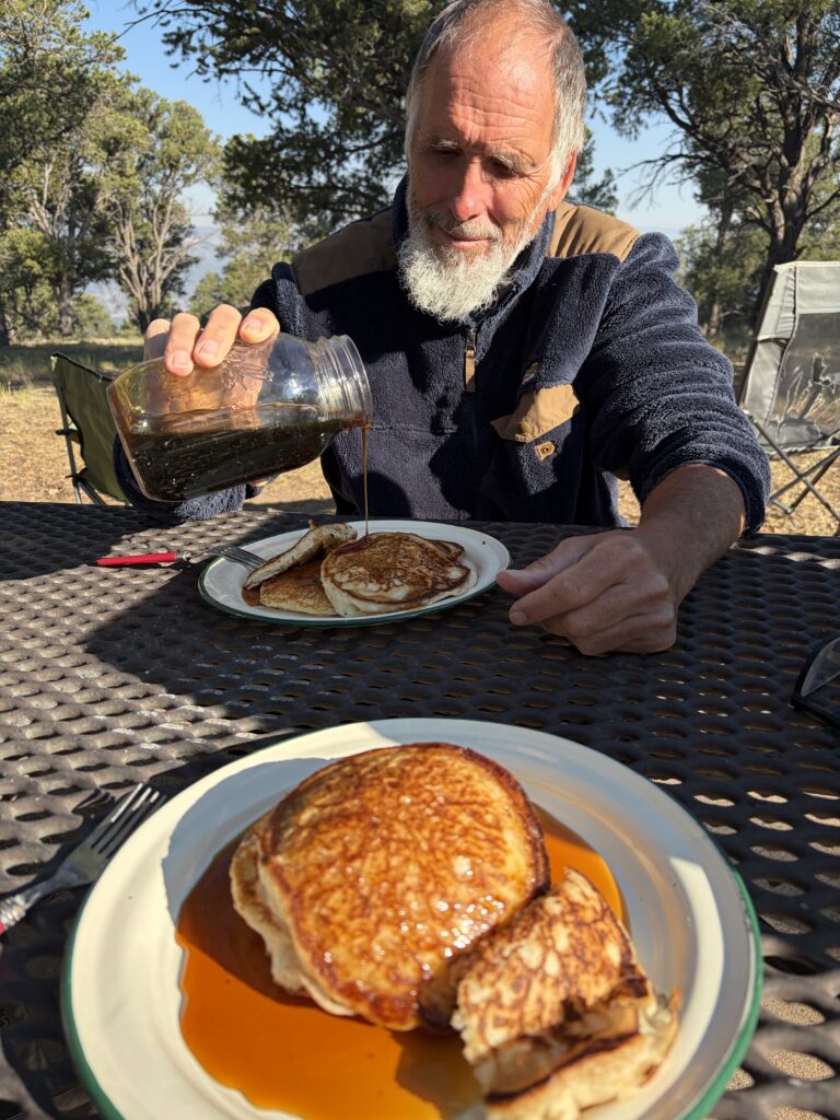
Our camp siteUp in the piñon pinesView of the lakeBreakfast in the mountainsMoe sploots!Beautiful blue-green water
I was delighted by the many Mountain Bluebirds and Black-Chinned Hummingbirds we saw there (I THINK I saw a Mountain Chickadee, too, but can’t be sure.). There would be more hiking pictures, and panoramic shots of the mountains, but it was so pleasant to sit in the shade, with a cooling breeze, that it was hard to get motivated (we did take one short hike to a scenic overlook).
I guess that’s the “Switzerland” part.
Later we drove to town and had dinner at the True Grit Cafe, a John Wayne-themed restaurant next to a city park teeming with frisbee players, picnickers, and people just hanging out in the shade. The John Wayne trivia was great, the meals not so much and, to our dismay, the ice cream parlor nearby closed just before we got there.
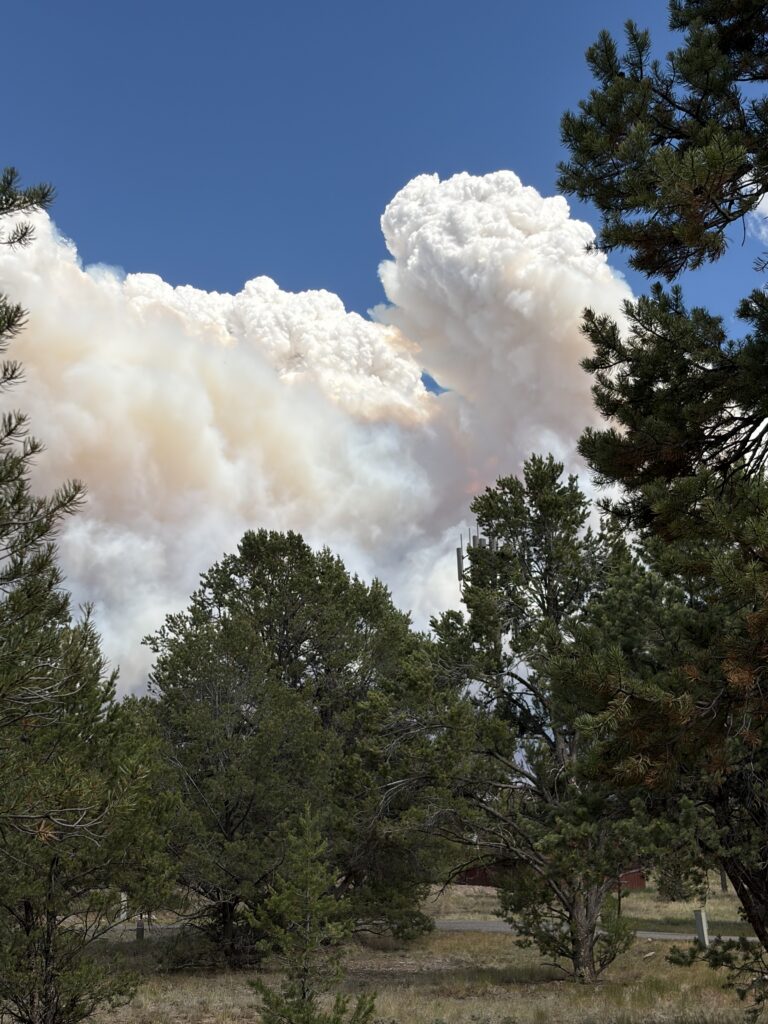
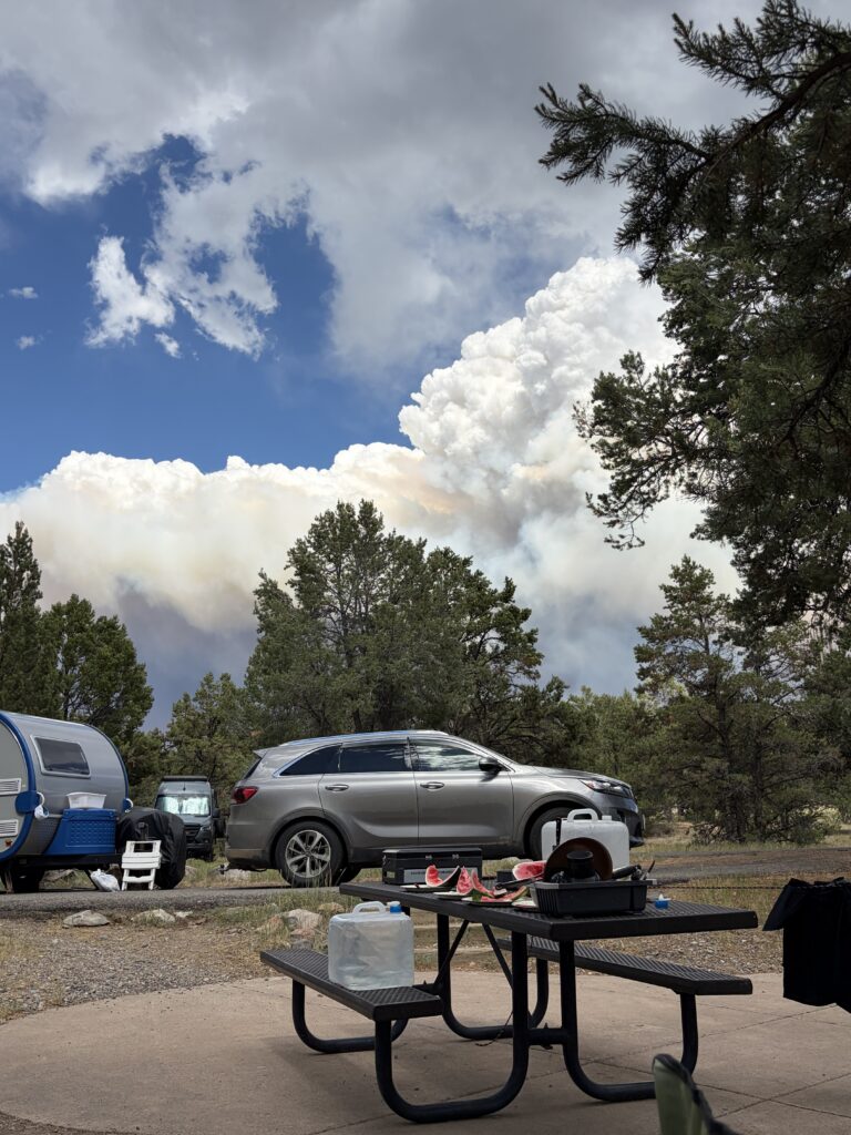
We only managed to get two nights at Ridgway, but it may have been just as well, as local wildfires were getting too close for comfort.
NOT thunderheads!Wildfire ash & smoke
On our way to Hovenweep National Monument, we saw plumes from several other fires, but we have been lucky so far in avoiding them. See Russ’s blog at russloomis.com for more impressive fireplume pictures.
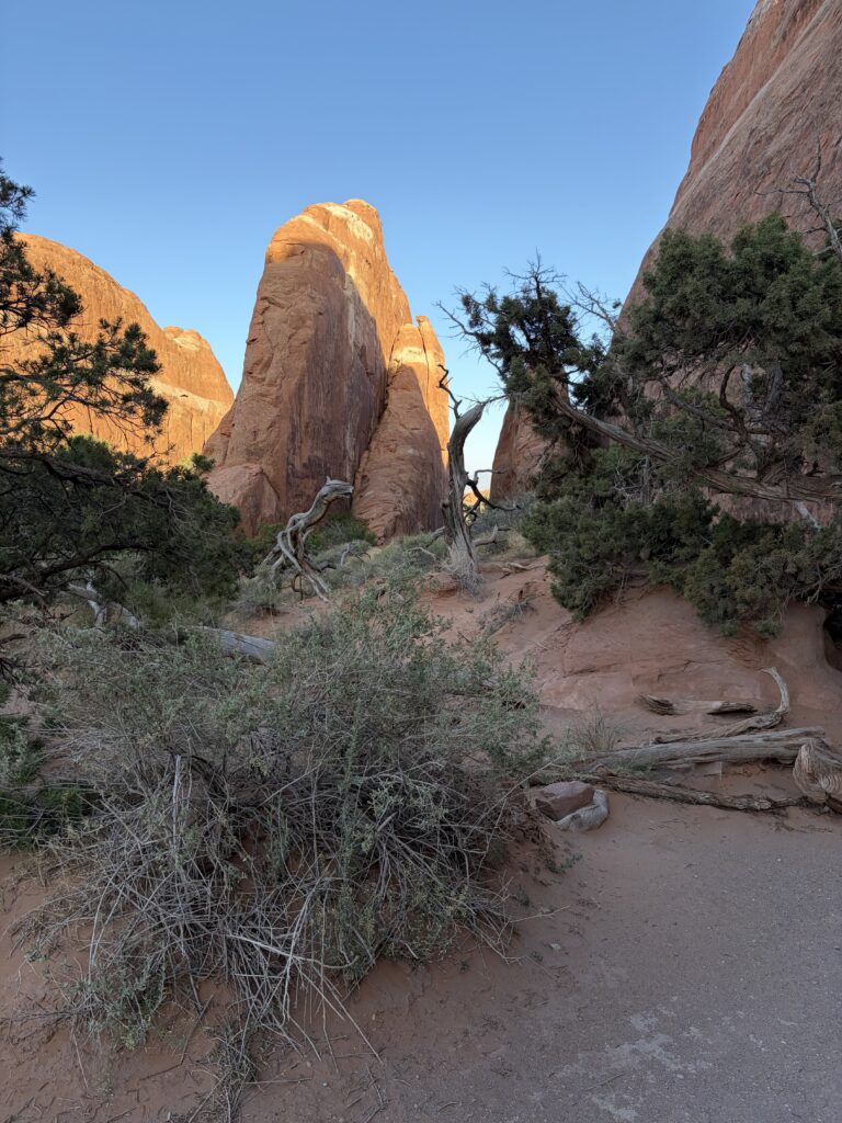
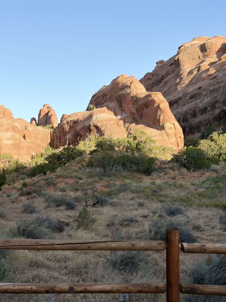
Sometimes it’s hard to write a blog because I’m too busy standing in astonishment of the scenery, or so wiped out from trying to see everything that I just lie down and konk out. Both happened at Arches National Park.
Our campground in Moab was only a couple of miles from Arches, and it had all the amenities. We were particularly impressed with the tent spots, which all had shade canopies covering the entire tent pad. There was also an “Airstream Village,” not for Airstream owners coming through, but permanently docked Airstream campers, each with its own shaded deck, that you could rent. Also cabins, full hookups, a pool, laundry, etc., etc. Very nice, very convenient. The first night, our neighbors recommended a restaurant called The Broken Oar. They allowed Moe on their outdoor deck, and we had a great meal.
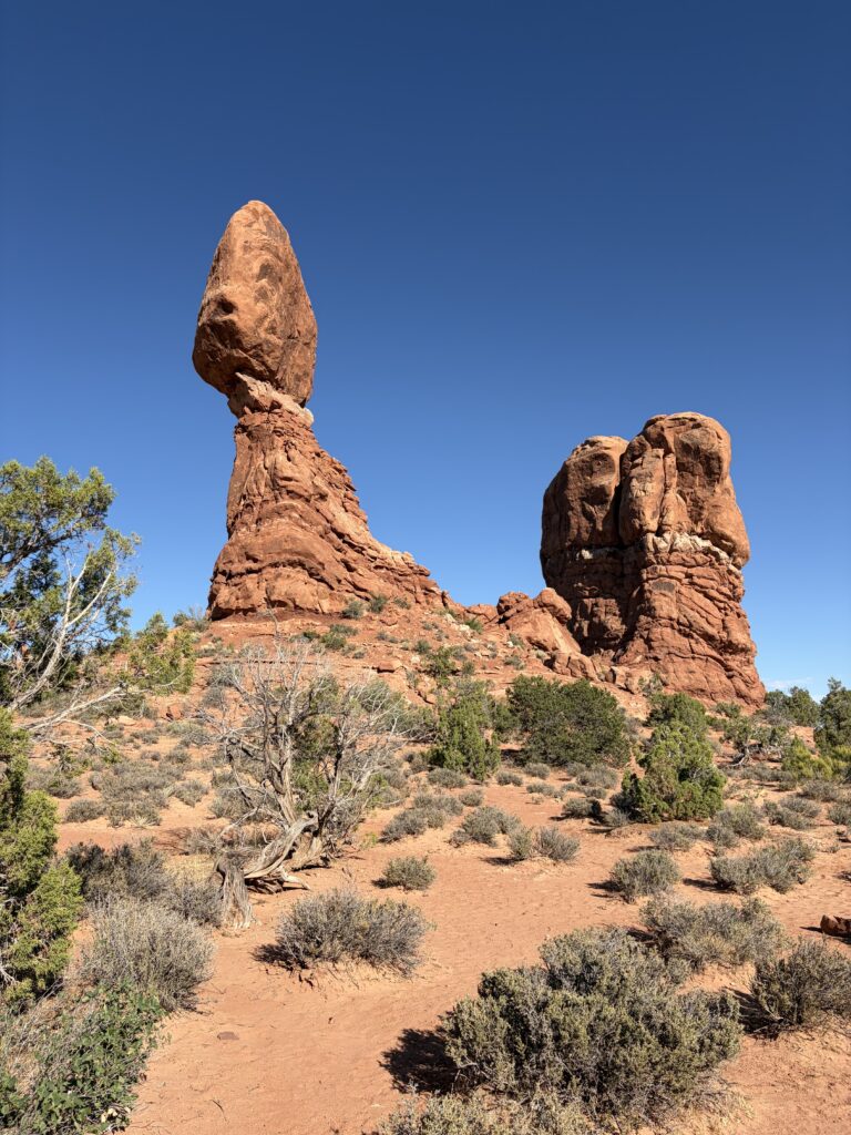
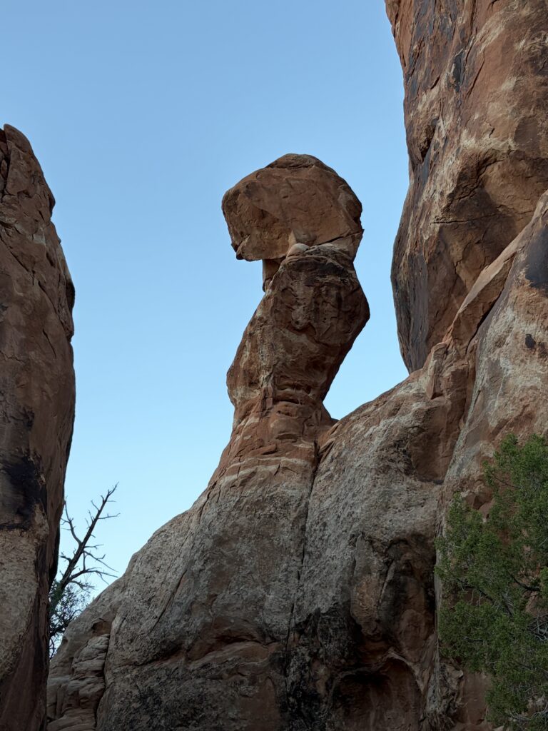
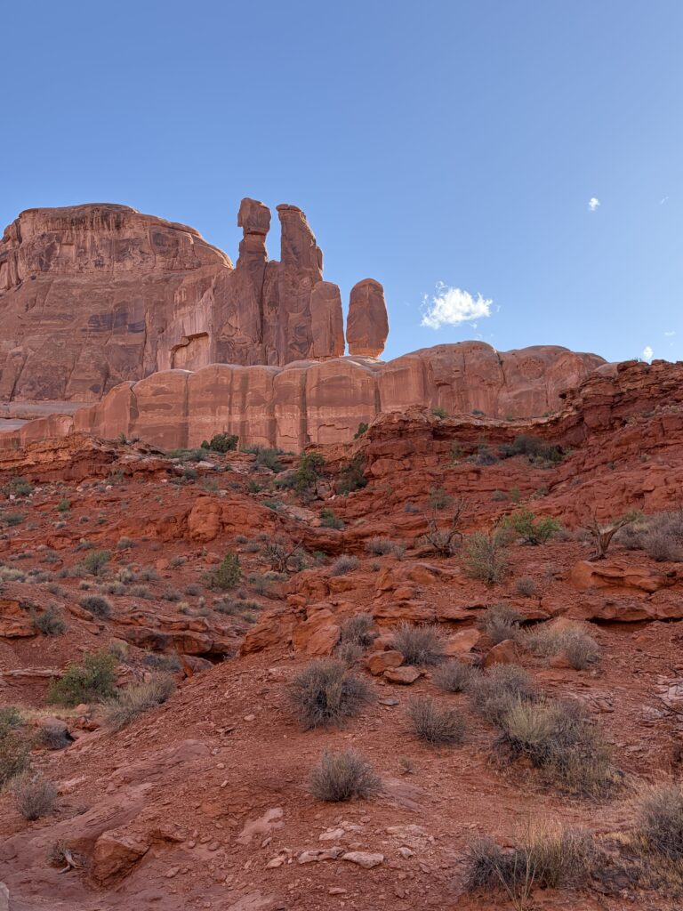
Early the next day, Russ was eager to go cycling. He picked up a bike trail guide and headed out for Arches. As often happens, I was bushed from yesterday’s long drive, so I slept in. When Russ got back, it was late afternoon and he was beat, so I headed to Arches on my own. That’s when I discovered how great Arches is at sundown.
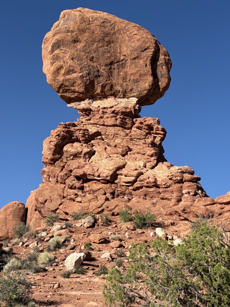
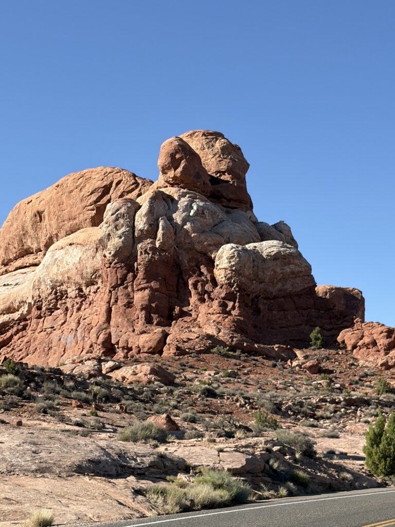
Climbing upStill climbing…Dramatic lightBalancing Rock from the frontBalancing rock from the sideCheeky ravens!Three masted ship?Made me think of the Sphynx
The ravens were a hoot—these were just teenagers, but they were very bold and loved getting ice cubes from one of the bus tour guides. He told me quite a bit about them, as he’d watched them grow up.
I kept seeing fanciful shapes in the rocks, as noted above. This one looked like the bust of Nefertiti.
And this one made me think of E.T.
I got back to camp with a bunch of pictures and a plan to return late tomorrow with Russ.
The next morning I walked out behind our campground into a nature preserve, hoping to see birds, as usual. Unfortunately, the ‘wetlands’ had long ago dried up, and except for the ever-present whiptail lizards, there wasn’t much to see. Russ stayed in camp to take care of Moe.
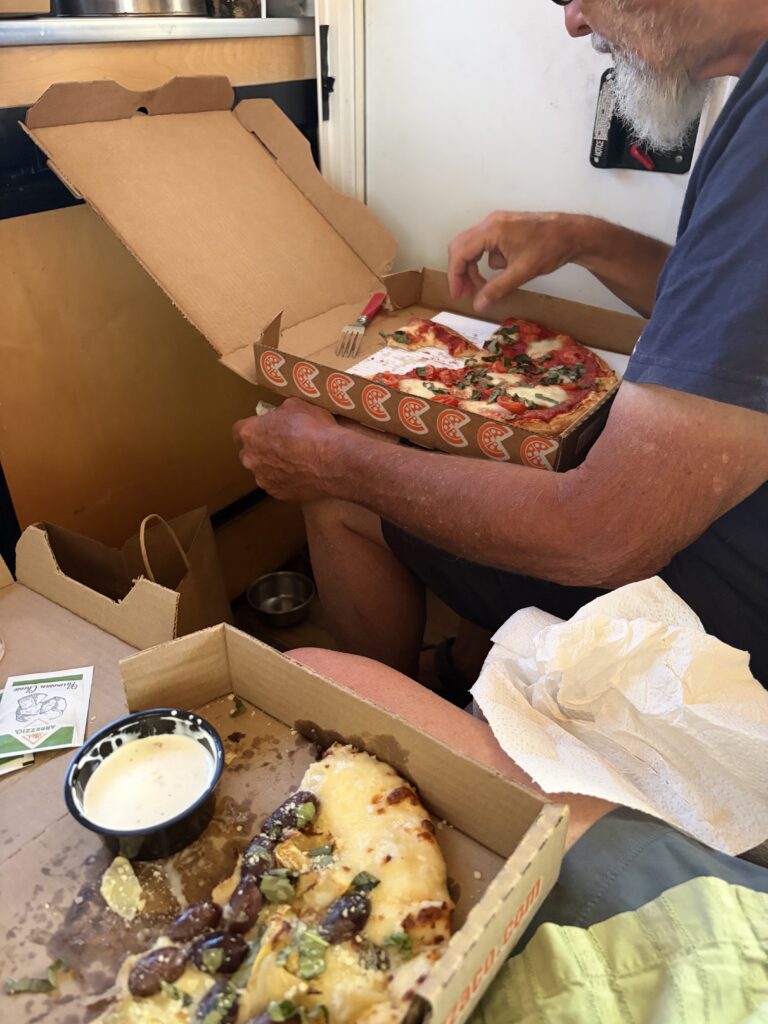
We both took a nap after lunch (the heat will do that to you), then ordered pizza (most excellent!) and headed back to Arches. We got there an hour later than planned, but no matter.
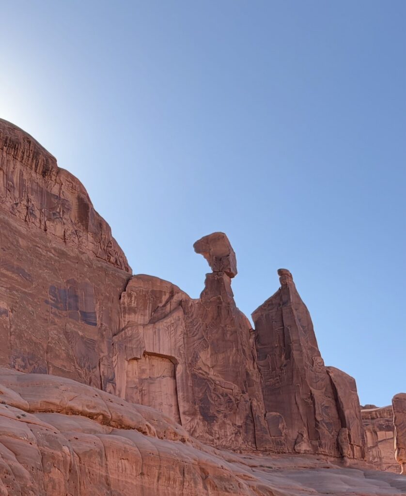
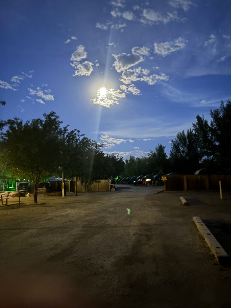
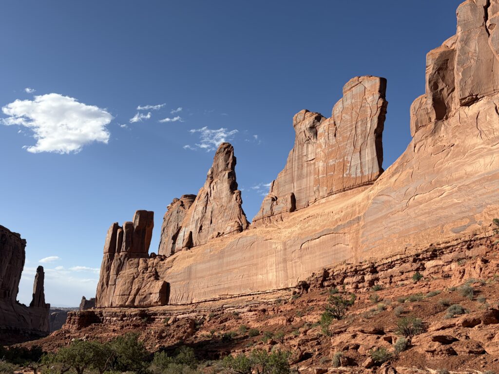
Excellent pizza!Campground later that nightEntrance to Park AvenueWalking down into the canyonBottom of Park Avenue trailLove this shot!Rocks are so red!Late light.
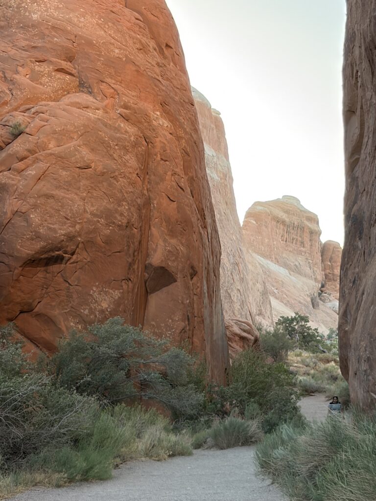
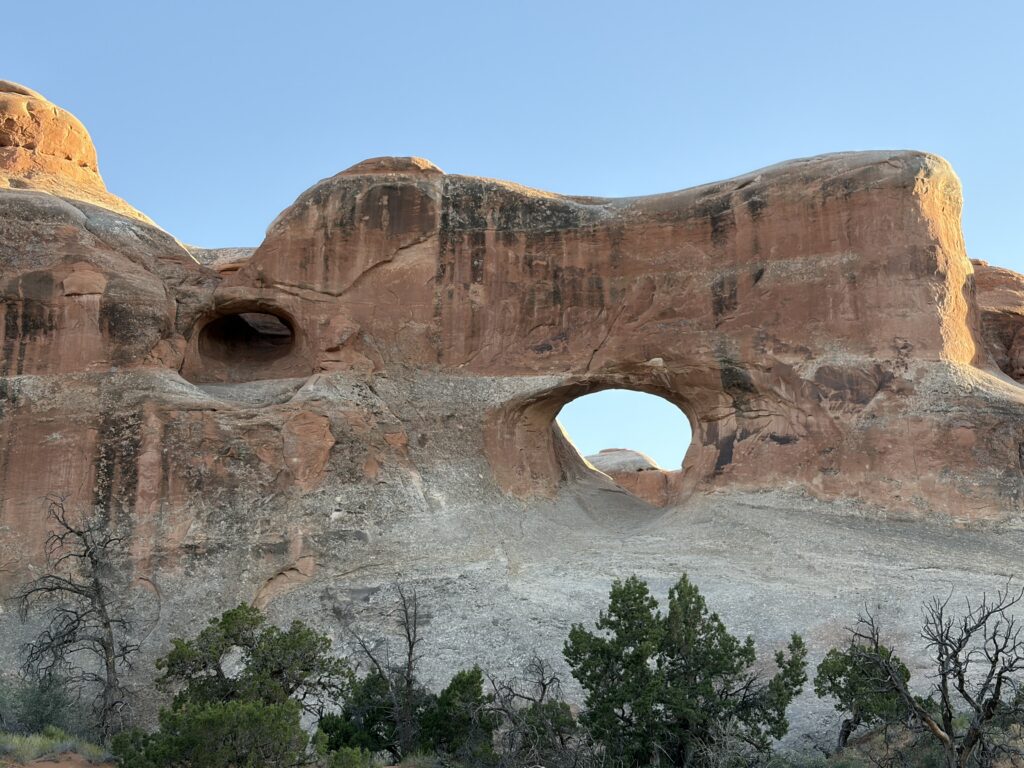
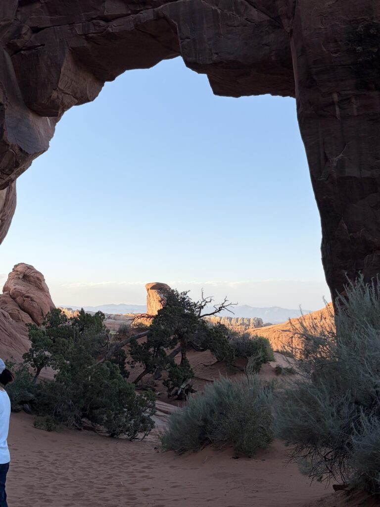
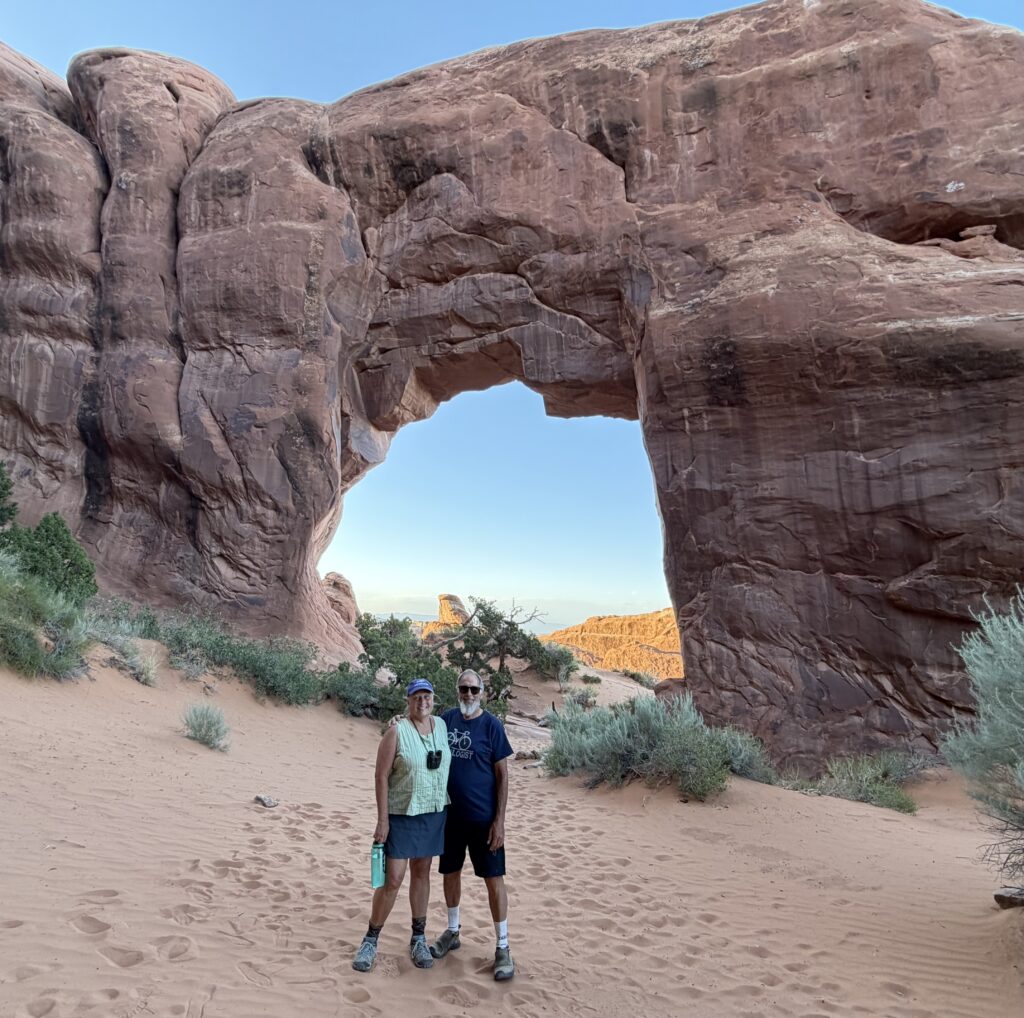
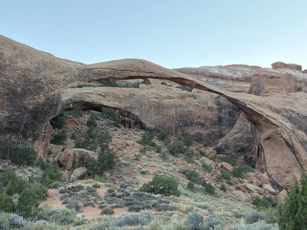
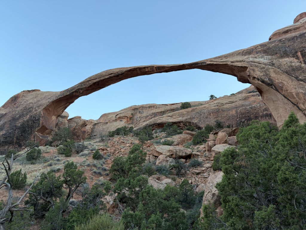
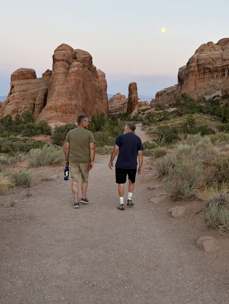
We planned to drive all the way to the park campground at Devil’s Canyon and hike to see some of the better-known arches. Met a fellow hiker, Alan, at Landscape Arch and he and Russ hit it off on the hike back.
Pothole Arch (there are two arches here)Canyon lightPine Tree ArchUs at Pine Tree ArchLandscape Arch—somehow I got an angle that looks like two arches crossingLandscape Arch at sunsetRuss makes a new buddy
We didn’t get to see everything we wanted to, as it was getting dark, so we planned to come back for a third day (Shoutout here to the America the Beautiful National Parks pass for seniors. For $80 I can visit as many national parks as I want, as many times as I want, for the rest of my life, all for free. One government program of which I thoroughly approve.)
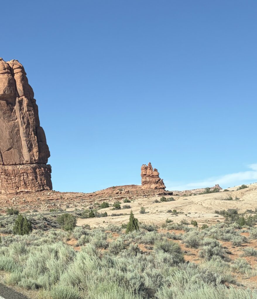
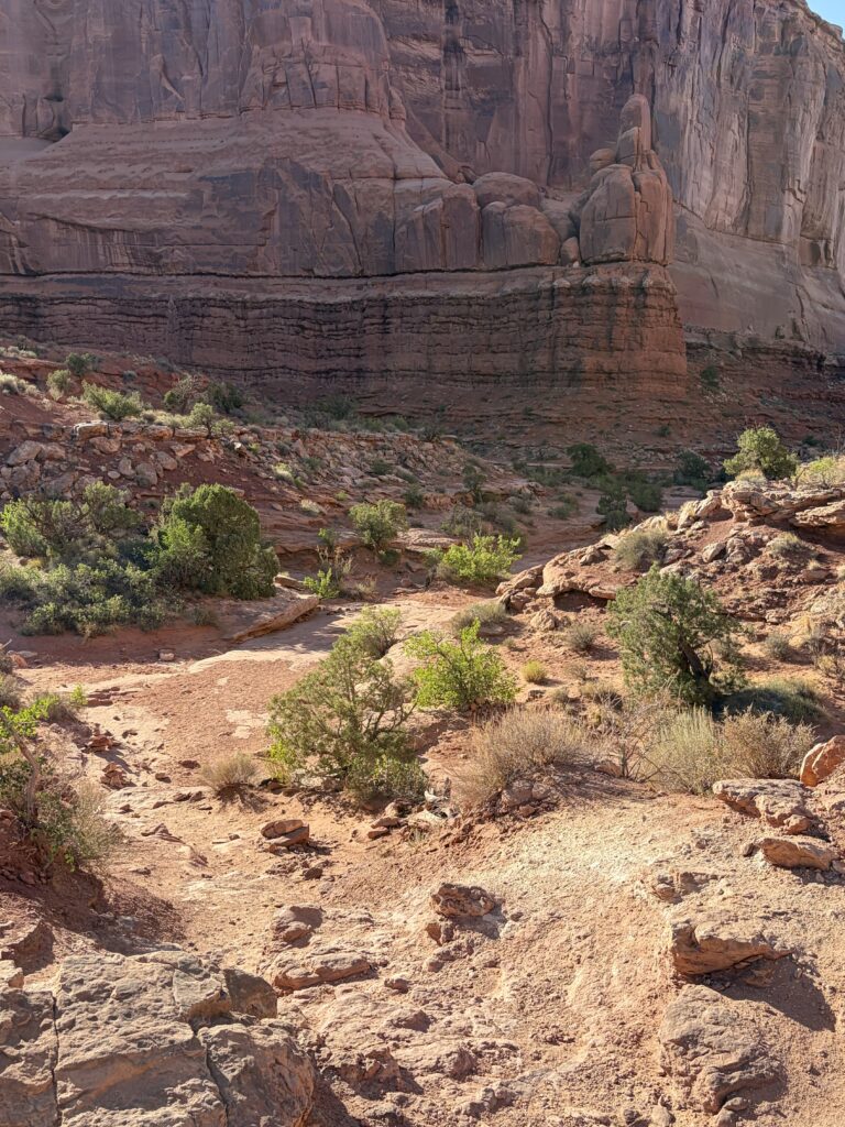
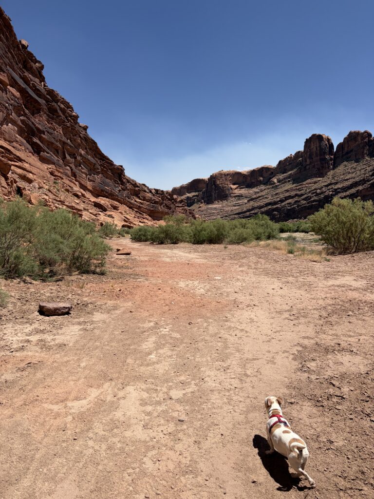
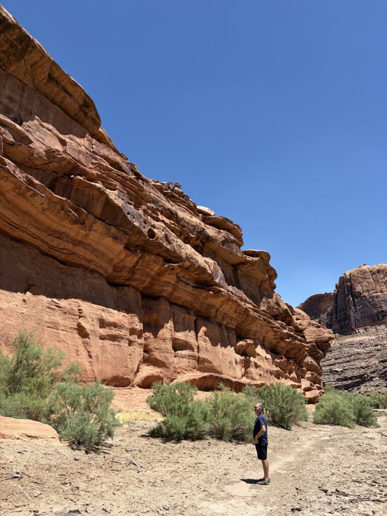
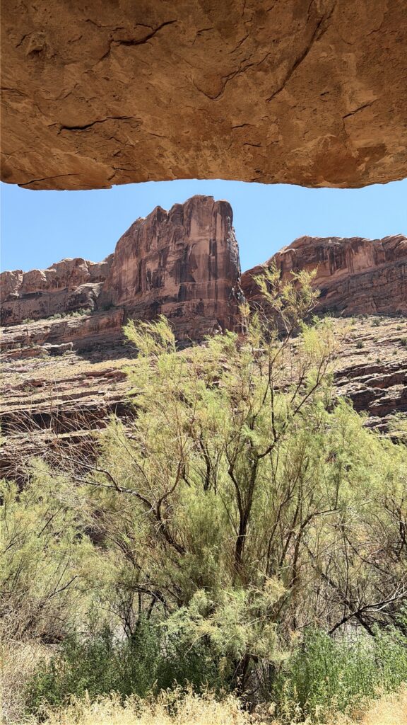
Russ wanted to take the bike/hike path along the river early the next day, but we were slow getting started, so it was pretty dang hot on that walk (Moe was stopping in every patch of shade). There doesn’t seem to be anywhere around Moab that doesn’t have spectacular red sandstone cliffs.
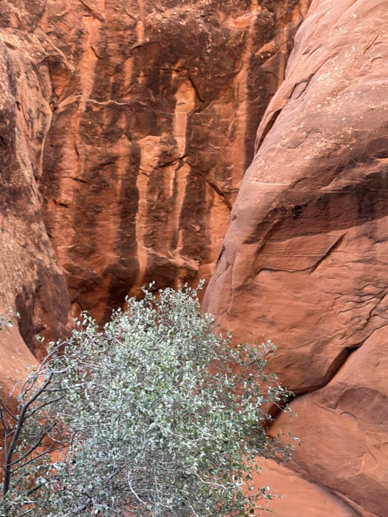
These overhanging ledges always make me nervousNo problem…what could go wrong?Only the intense heat could persuade me under this overhang
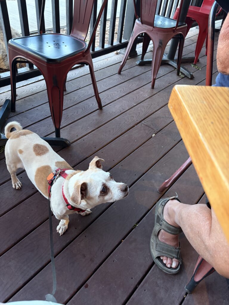
It’s hard to realize how much the heat is affecting you, since you never really get sweaty in that dry, windy climate. For me, it’s when my mouth is dry no matter how much water I drink that’s a warning sign. Anyway, we got back from that walk and both passed out—and slept all the way to 6:30! Even after our ‘nap’ we were too tired to go back to Arches , so a few sights will have to keep for another trip. We decided that a nice dinner would make a fine substitute. Another great meal, and Moe was the center of attention from waitstaff and customers alike out on the patio.
Moe waiting for Russ to say “Oops!” and drop another tidbit. A waitress brought him a pup cup without our even asking!
We both took showers before leaving on Monday, and I had one last surprise treat—I shared my shower with one of those whiptail lizards. I wasn’t bothered by him/her, but I thought soap might be bad for a lizard, so I gently picked it up and placed it by the shower exit. It promptly said “Oh hell no” and raced right back into the shower. I decided to respect its right to live where it pleased, and left it there.
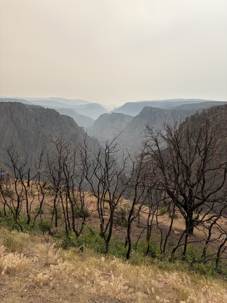
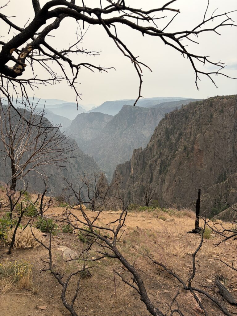
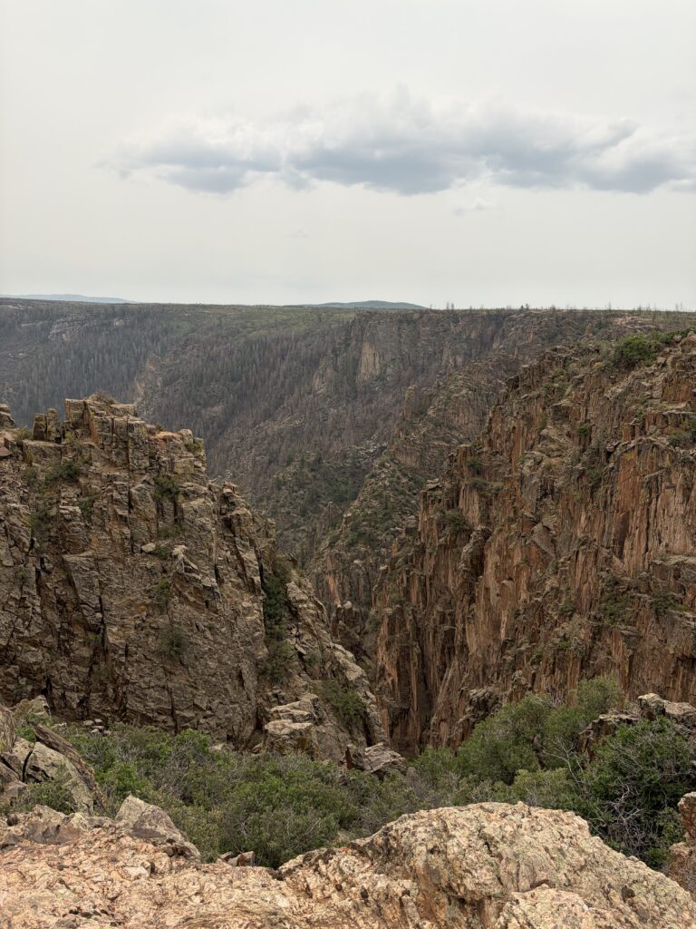
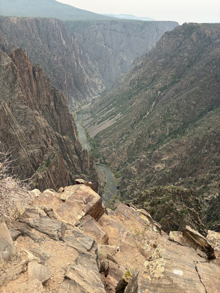
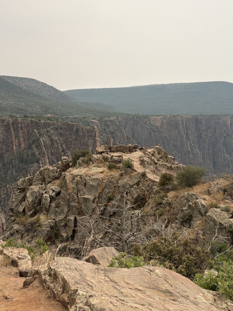
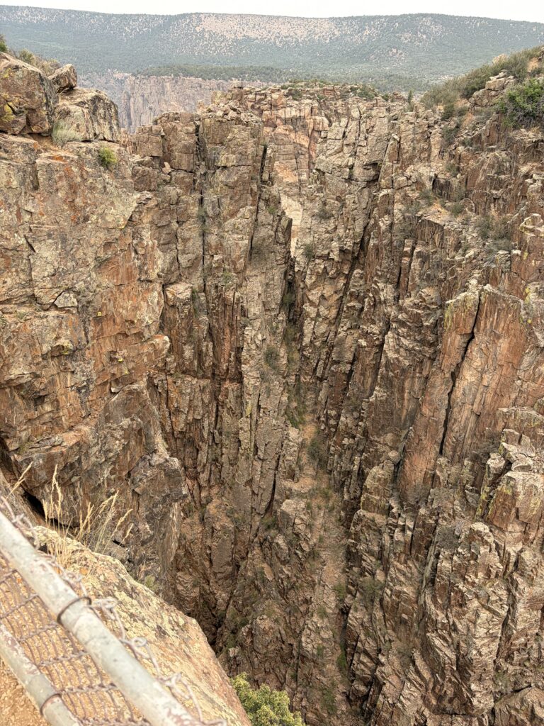
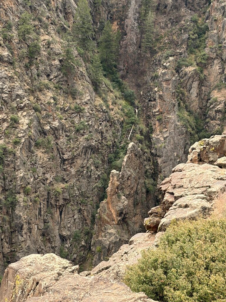
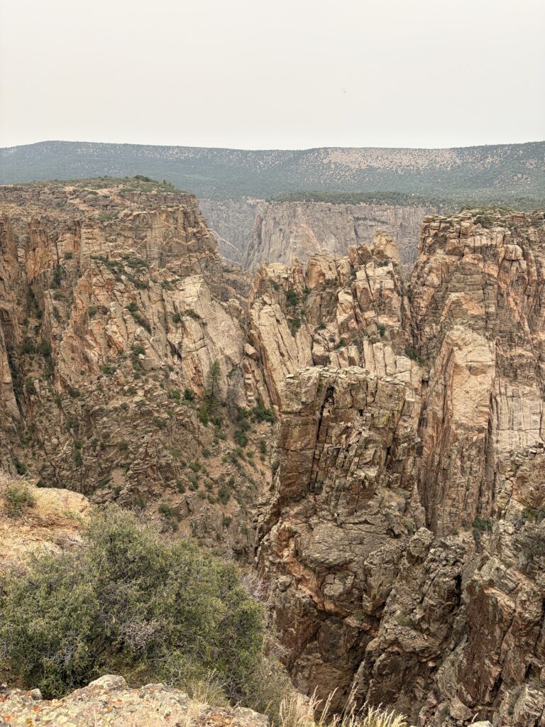
Nothing I say about this place would do it justice. This canyon is up to 1/2 mile deep, and so narrow in places between near-vertical cliffs that you can’t see the bottom, even standing almost directly above it. They say some areas on the floor of this canyon only get a maximum of 3-1/2 hours of sunlight a day. That is some seriously deep canyon. No wonder they call it “Black.”
Unfortunately, recent wildfireshave destroyed most of the treesat the top of the canyon’s south rim
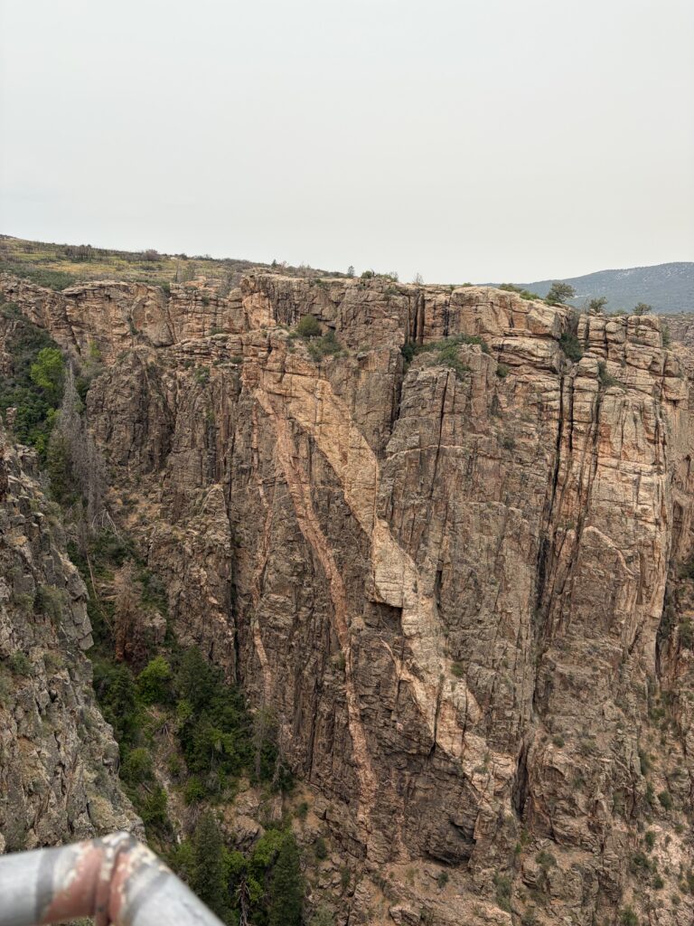
This is Pulpit Rock
and this is the view from there.
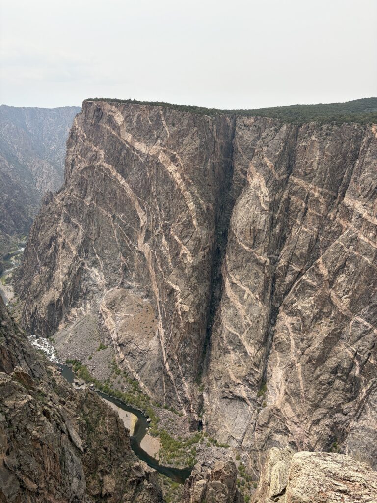
We saw Painted Wall, the tallest vertical cliff in the U.S.